The Sunshine Coast

I grew up and went to school in a medium-sized city in the west of Germany, located roughly halfway between Cologne and Frankfurt. When I was around 16, we went on a school trip to England. We did not go to London. We did not go to Oxford, Cambridge, or maybe Brighton. We did go to Clacton-on-Sea, on the Essex coast. More specifically, we went to a caravan park on the outskirts of Clacton.

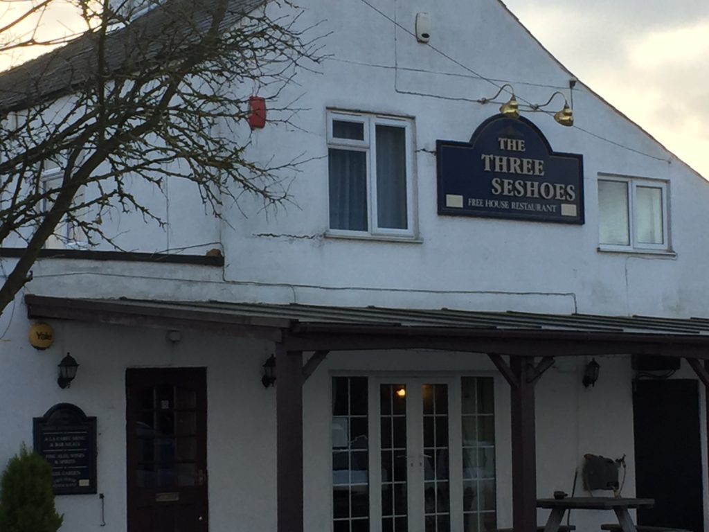
This did not seem so strange at the time. Looking back, however, Clacton strikes as me as a very unusual destination for the school trip of a German school. Who decided on the Essex coast, and for what reason? Was the experiment repeated? In recent years I have often wondered about this, but doubt that I will ever know the answers.  The only clear connection between my hometown and Clacton I have been able to ascertain is related to a fried chicken restaurant which I will call FC. In Britain, FC can be found in many cities. In Germany, there is exactly one branch – which happens to be located where I grew up. It is legendary for being open until very late at night, thus providing food to partying teenagers. This striking fact raises questions of its own – why is there only this one branch, why is it here? – but it hardly answers the puzzle of how I ended up at a Clacton caravan park for a week.

I still have some distinct memories of the trip. We travelled by coach, taking the ferry to Harwich, and on arrival at the caravan park the coach stopped next to a football field. While waiting for the doors to open, we watched two boys involved in a fight rolling around on the ground outside. I remember plenty of tinned ravioli and creatively seasoned pasta. I do not recall any day trips for sightseeing, but I do remember a trip to a big Tesco supermarket.

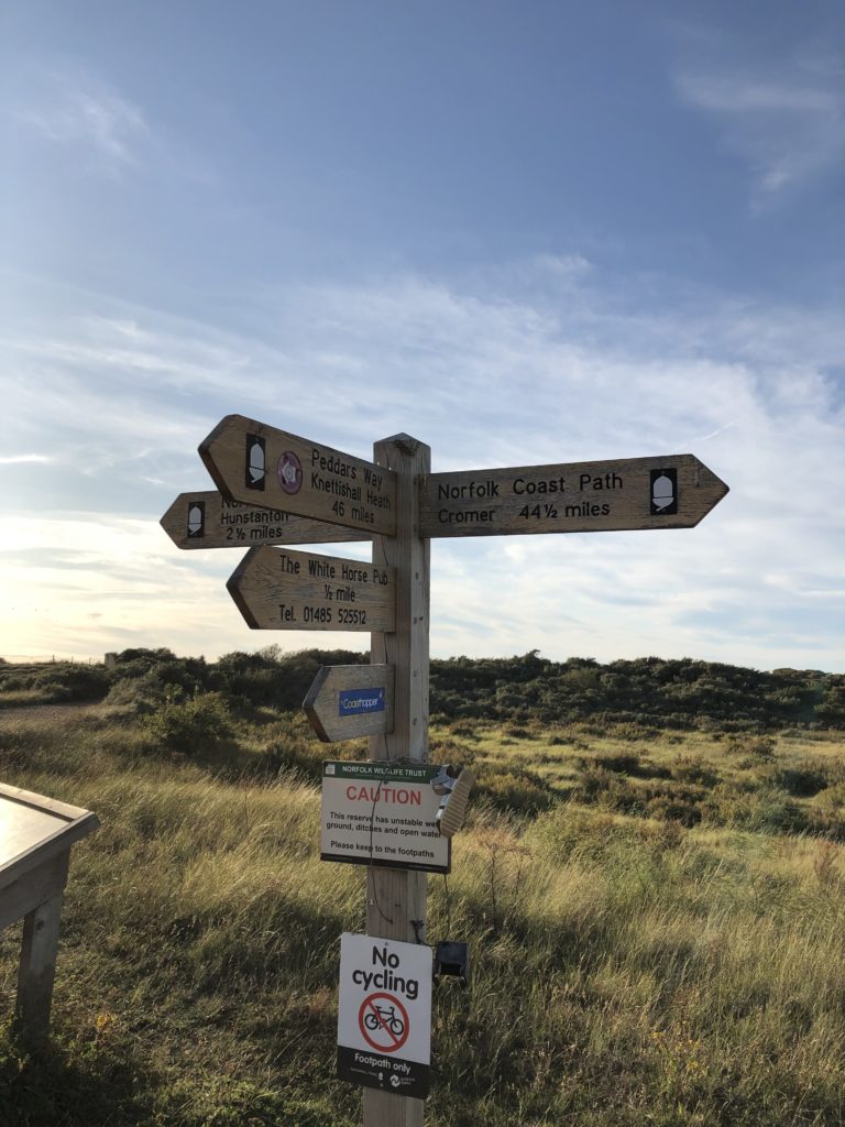
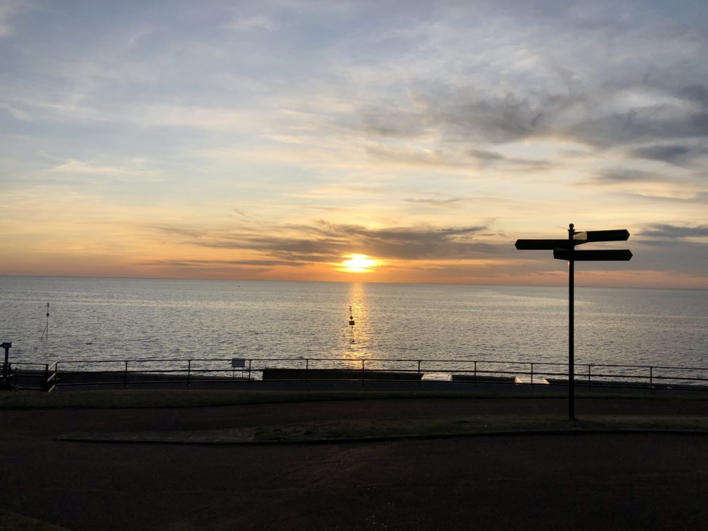
Some years ago I identified the exact location of the caravan park from my youth, and had been meaning to go on a trip down the memory lane ever since. On a very fine day in early January 2023 I finally implanted this plan and headed to Essex’s sunshine coast, starting in Walton-on-the-Naze and heading south towards Clacton, Jaywick, and St Osyth.

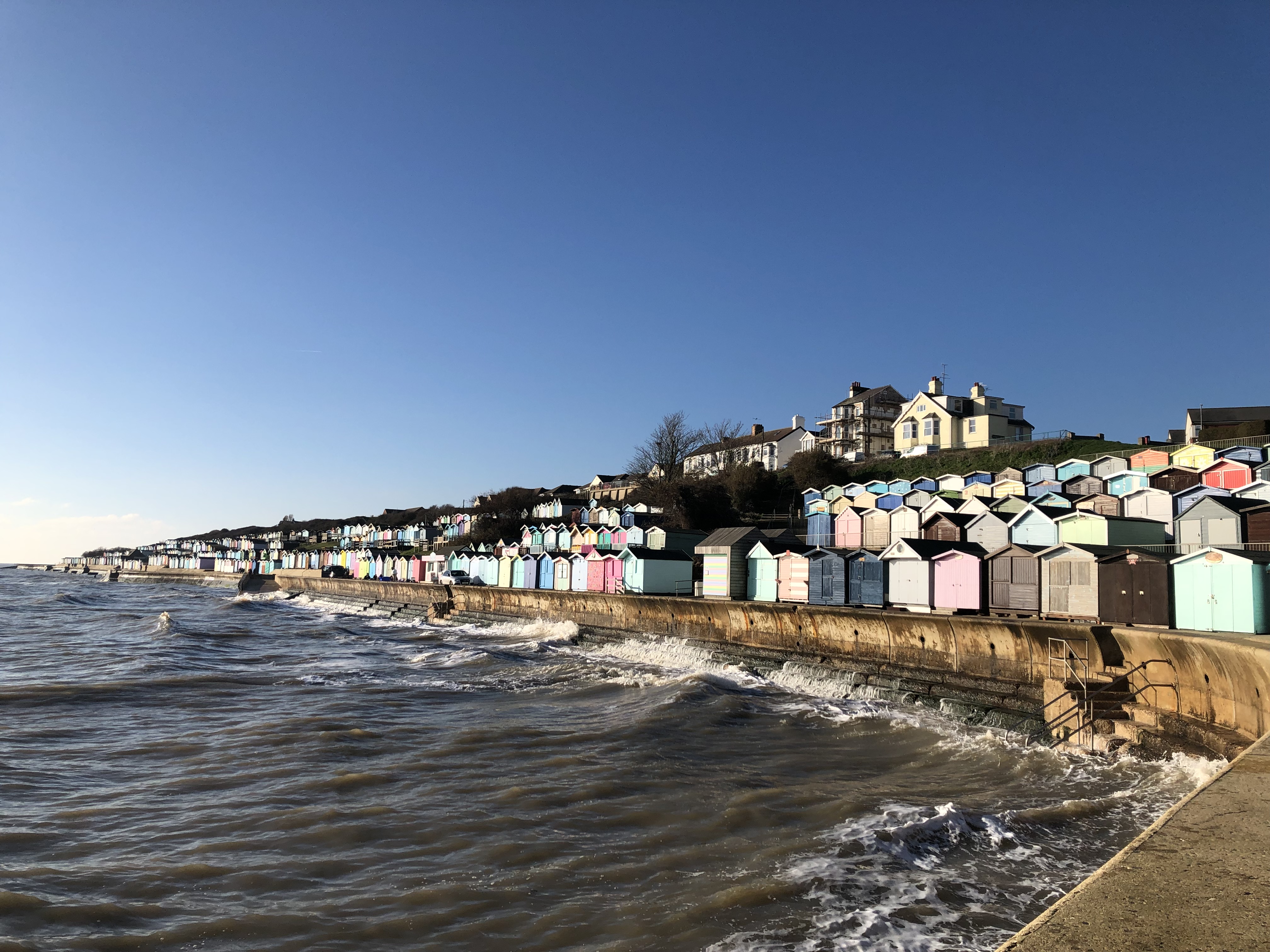
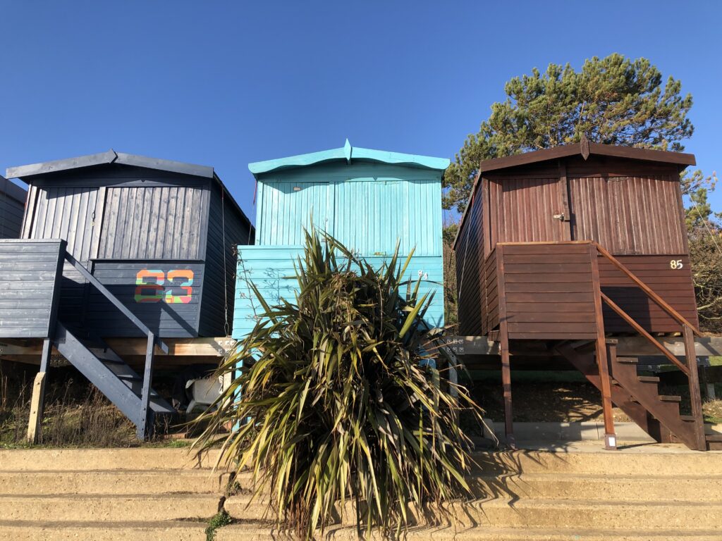
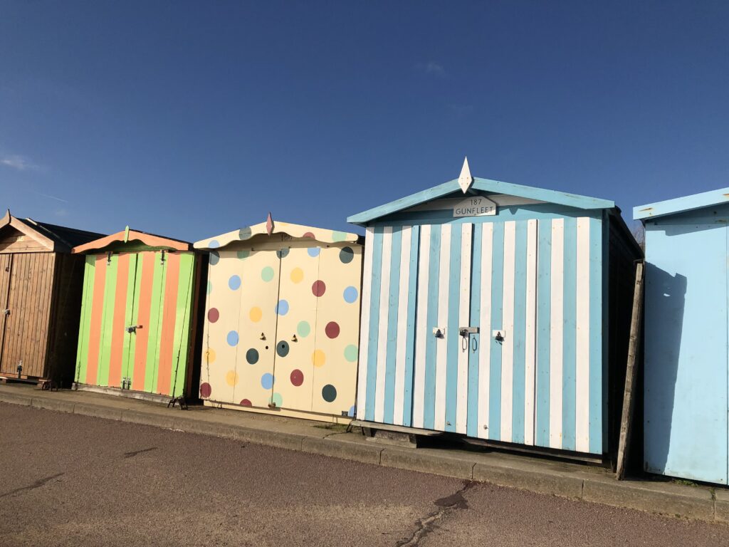
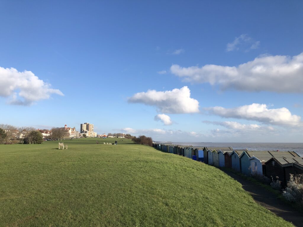
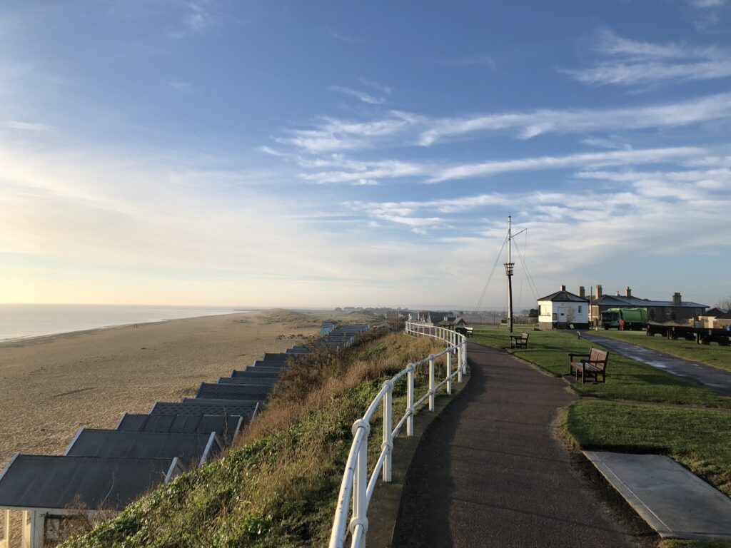
Walton-on-the-Naze has a pier, but one’s attention is quickly drawn away from it by the large number of colourful beach huts. I have been on many coastal walks, but I had never seen this many beach huts of all shapes and varieties before.

While they exist in other countries, to me beach huts feel like a very British, or maybe even English, phenomenon. This feeling might have been influence by R. C. Sherriff’s 1931 novel The Fortnight in September. It follows the Stevens family from Dulwich in south London on their annual two-week holiday to Bognor Regis. There is little discernible action, but Sherriff excels at empathically describing the hopes, dreams, anxieties, and annoyances of everyday life. Among the various trials and tribulations the Stevenses face, one concerns the “the booking of the bathing hut” which “was always done on their first evening walk”. For a long time they are on the fence about which type of hut to rent: an ordinary, plain one or a more upscale – and hence more expensive – model with a small balcony. Finally the decision to indulge in the more luxurious hut is made – but then none of that type turns out to be available! Luckily the disappointment doesn’t last long, since they are able to rent one that becomes available on the following day. General contentment results:

It could not possibly have worked out better: they would not only save five shillings, but they would enjoy the hut much more through having to wait for it. It was theirs now, to all intents and purposes: they would stroll by and look at it tomorrow: they would picture themselves grouped round it—sitting on the balcony, hanging their bathing dresses over the rails—and then on Tuesday night they would unlock the door and go in: they would sit just inside and look out over the moonlit sea, and the soft music of the band would come to them faintly on the wind.

Beach huts are not popular in Germany. Instead, we have Strandkörbe – “beach baskets”, so-called because they are weaved, similarly to actual baskets. They are meant to provide shelter from sun and wind while sitting on the beach. Strandkörbe were invented in Rostock in the late 19th century, and to this day they are extremely popular on both the North Sea and the Baltic Sea coasts.

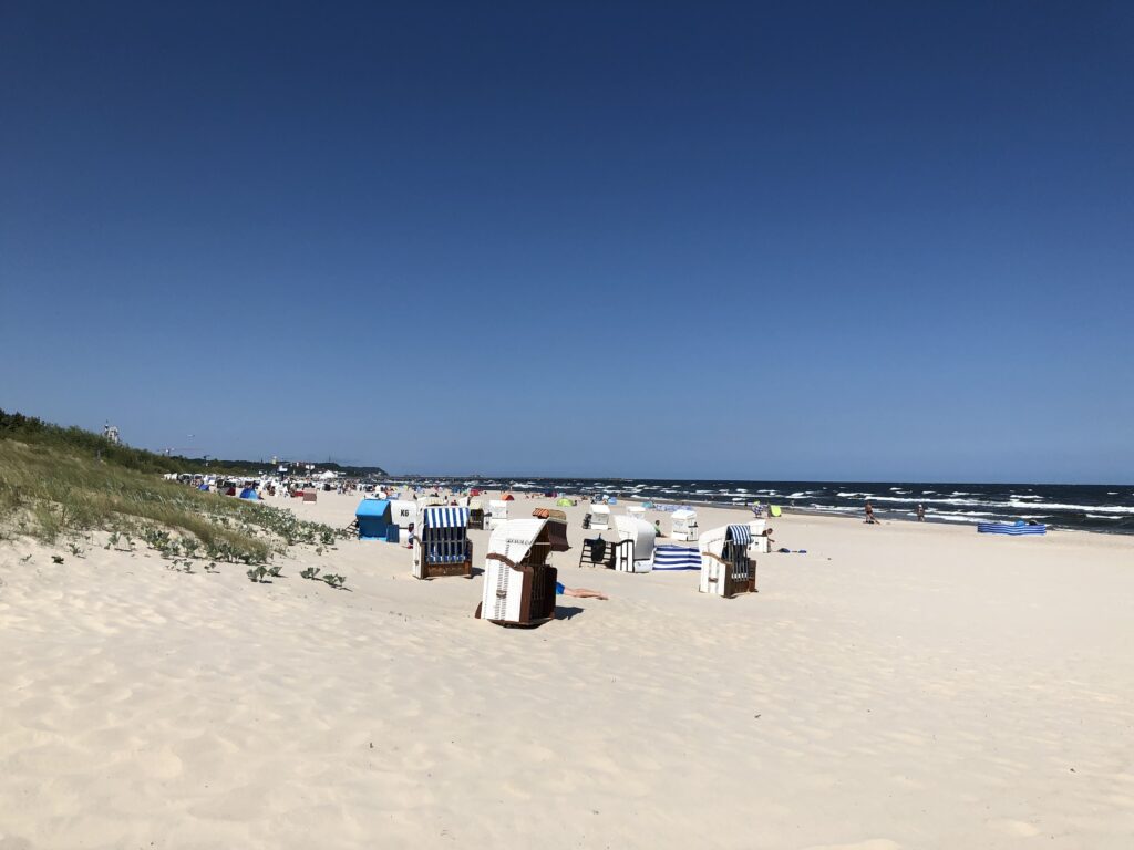
Outside of Germany, on the other hand, Strandkörbe are virtually non-existent, and hence there is not even an English term for it. One feels that their popularity must reveal something about the nature of Germanness. But it is hard to say what exactly. One salient stereotype is that Germans like to reserve spaces at the pool by putting down towels early in the morning, so a desire for securing a basecamp close to the water looks like a promising explanation. But this could arguably be fulfilled by beach huts rather than Strandkörbe as well, and so the German preference for the latter options remains mysterious to me. (A related but equally tricky question: If Austria had access to the sea, would Austrian beaches have Strandkörbe?)

To the south Walton is bordered by Frinton-on-Sea, which has no pier, and, until 2000 didn’t even have a pub. A large share of the population is retired, giving the place a quiet, conservative, and genteel character. Less flatteringly, a saying has it that while the aforementioned and nearby Harwich is for the continent, Frinton is for the incontinent.

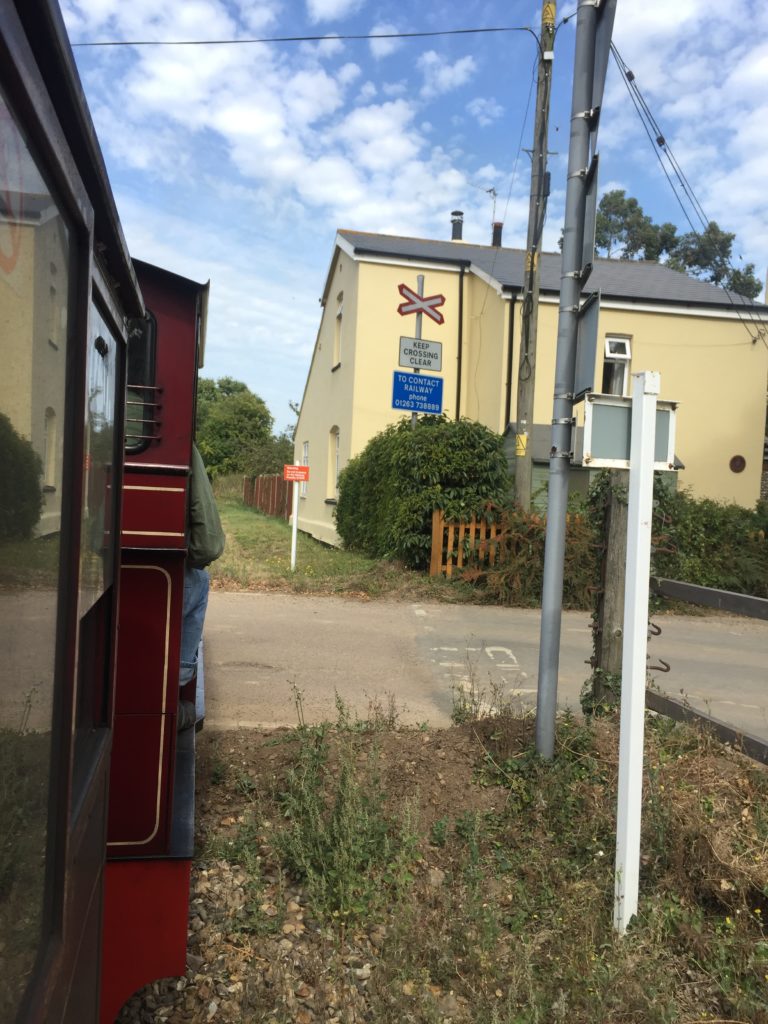
Much of Frinton lies between the sea and the railway line. There is only one access road, and when the barriers at the railway crossings close Frinton is thus temporarily isolated from the rest of Britain, similarly to Mersea Island with its Strood. Until 2009 the railway crossing was operated manually, with a person opening and closing the “Gates” when trains approached and left. Living “within the Gates” is a status symbol, and Frintonians are passionate about them. When a plan by Network Rail to replace the manually operated barriers with an automatic system became known, fierce opposition ensued. The thought that some “lunatic in Colchester” would remotely operate the Frinton barriers shocked many residents, and a representative of Network Rail was booed at a public meeting. At a rally, slogans like “What do we want? The Gates!” were shouted. Intimated by such a forceful showing, Network Rail resorted to sneakily removing the old gates in the “cover of darkness” at 2.00am in the morning, when everyone was asleep. The whole saga is recounted in an excellent BBC documentary, which features a several interesting Frinton personalities.

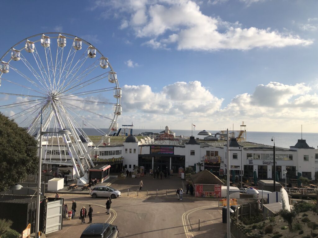
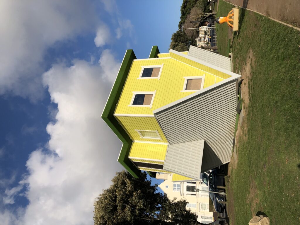
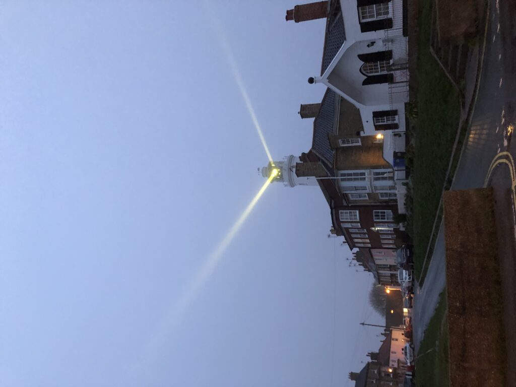
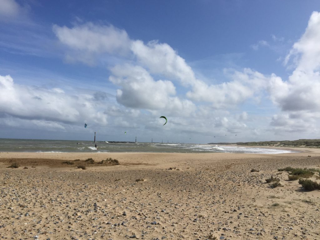
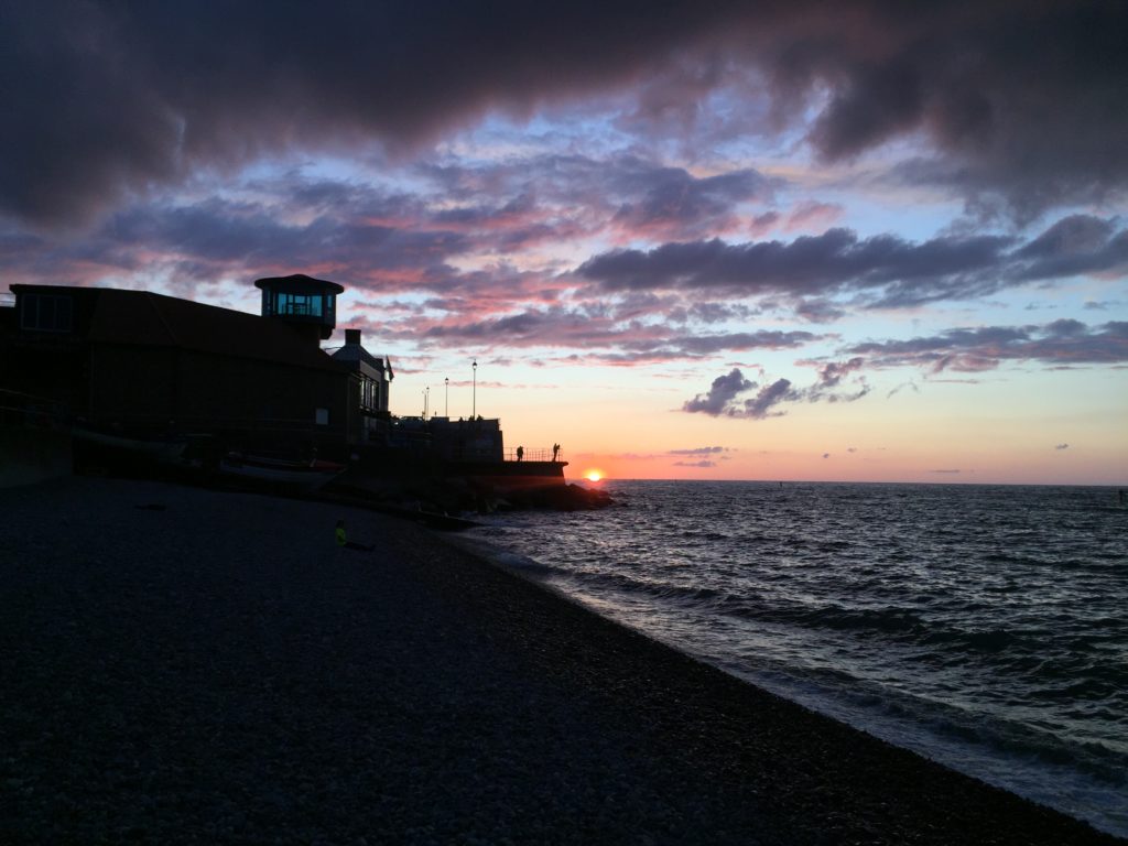
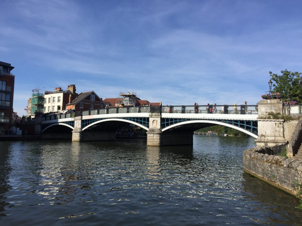
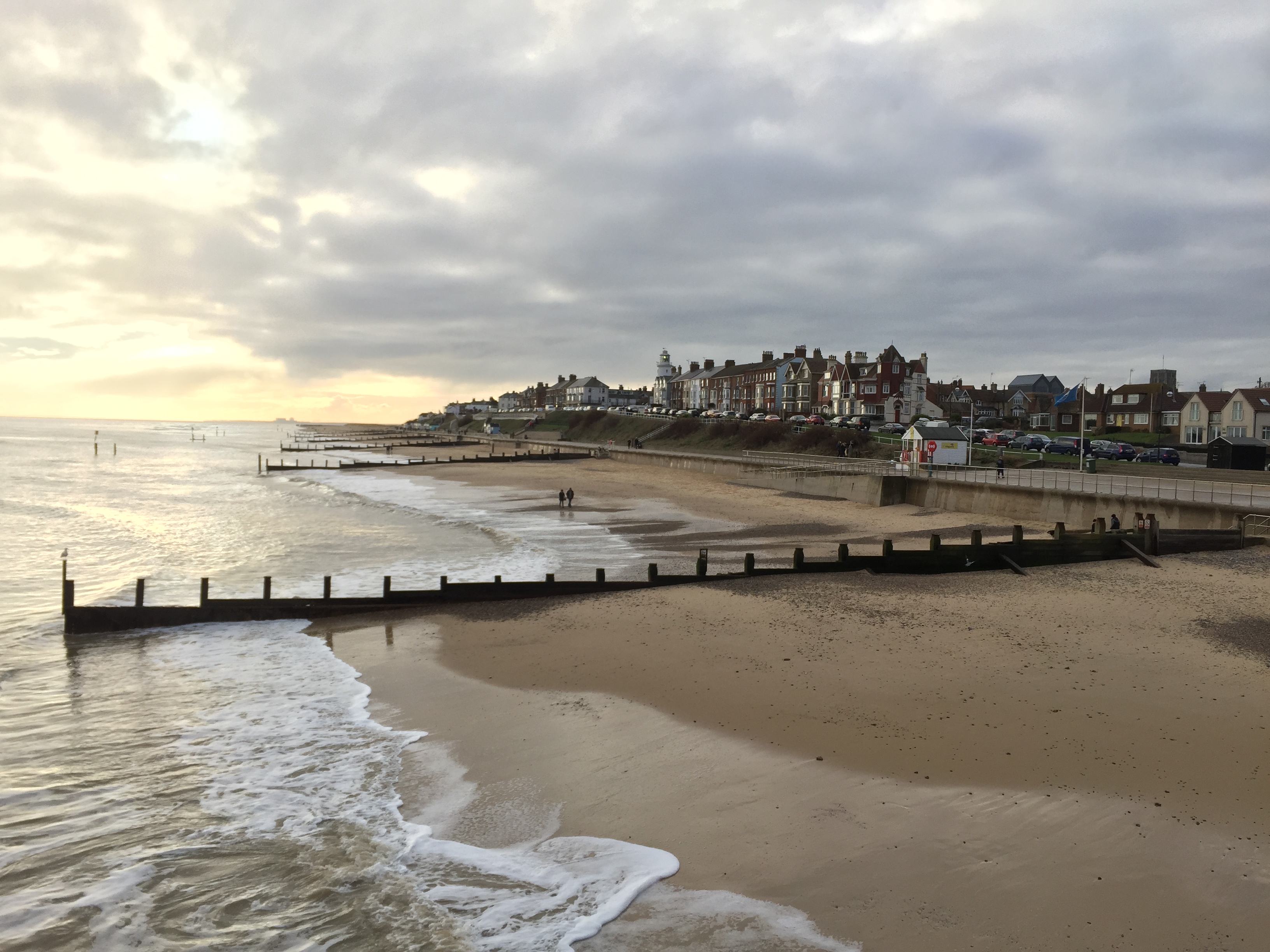
Clacton, on the other hand, is flashy, with a massive pier, a ferris wheel, amusement arcades, and an upside-down house.

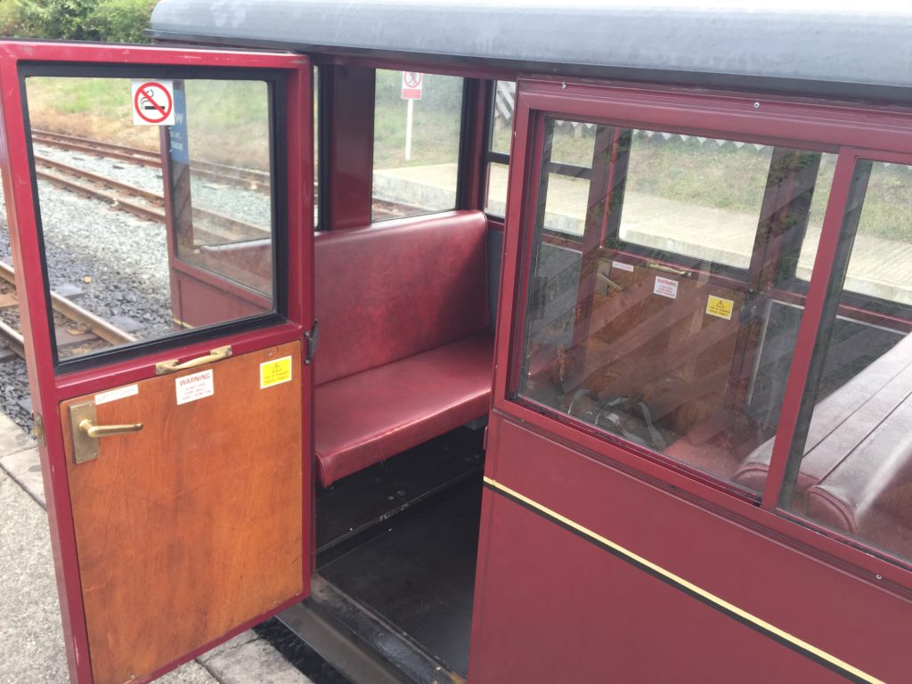
I did not have much time to explore Clacton proper as I was still quite far away from the sought-after caravan park, but I spent some time playing on a penny pusher in one of the arcades. I wrote about my passion for these machines on two previous occasions, and it is now appropriate to elaborate on the origins of this fascination. On the last day of the Essex school trip, I had still around £20 in cash. Since I didn’t want to take them back to Germany I looked for ways to spend money, and stumbled across a tiny arcade that was part of the caravan park. It had a coin pushing machine, and I had plenty of fun with the approximately 1000 2p coins I threw into the machine.

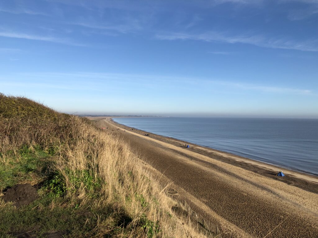
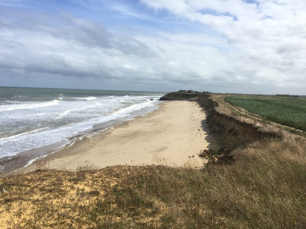
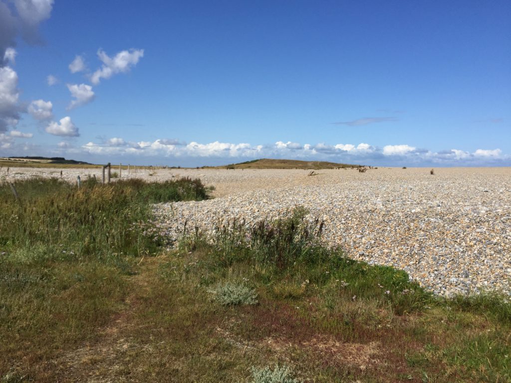
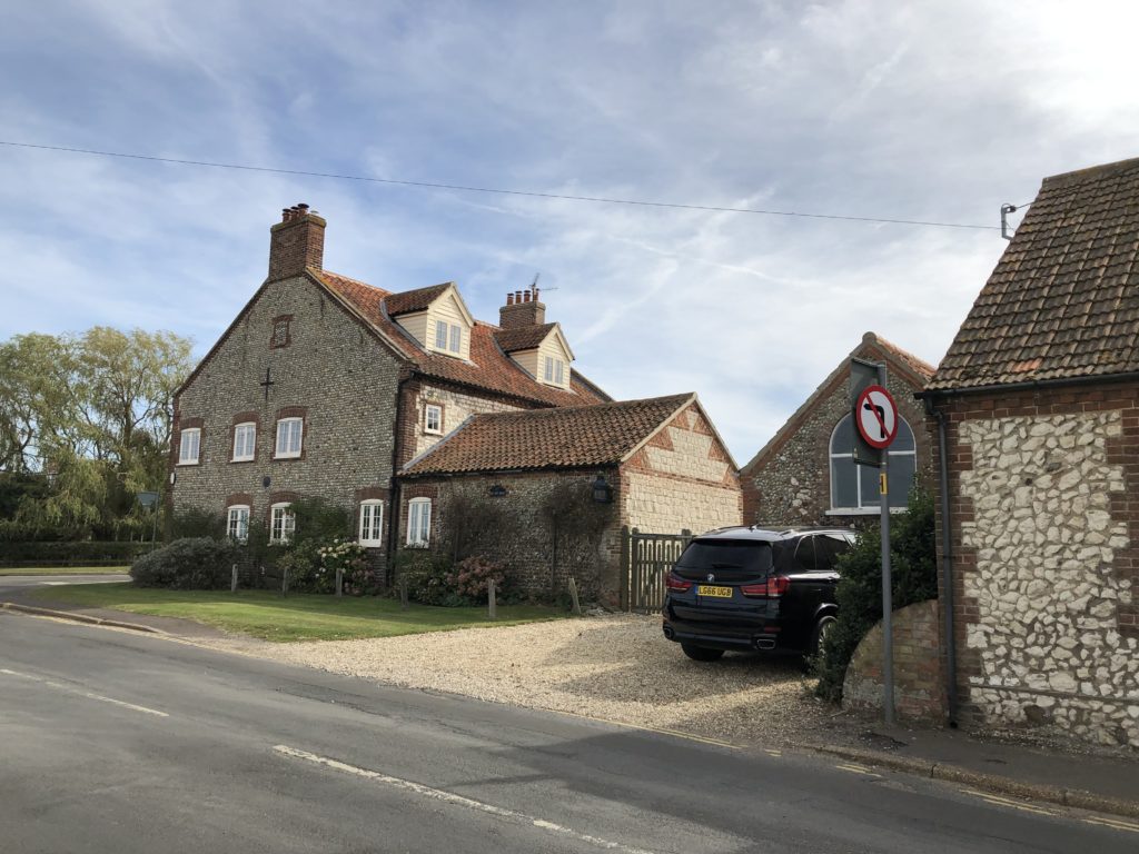
Heading further south from the centre of Clacton I soon reached the coastal village of Jaywick. It is somewhat notorious for having been named the most deprived area in England several times. Until the 1930s this area was just marshland, but then developers started to encourage people to buy land at affordable rates in order to build holiday homes on it. Many made use of this opportunity, but the houses that resulted were often of poor quality and not very suitable for living in them all year round – which became more and more common nevertheless. Despite some redevelopment efforts many properties in Jaywick are in bad shape even today, and I walked past more than one boarded-up prefab along the seafront.

Given its remote location unemployment is also high, which together with the poor housing conditions leads to various other social problems. In recent years life in Jaywick has been covered in a number of documentaries, some better than others. Without such prior priming, to a casual visitor Jaywick will probably not appear more badly off than many other towns on the East coast though.

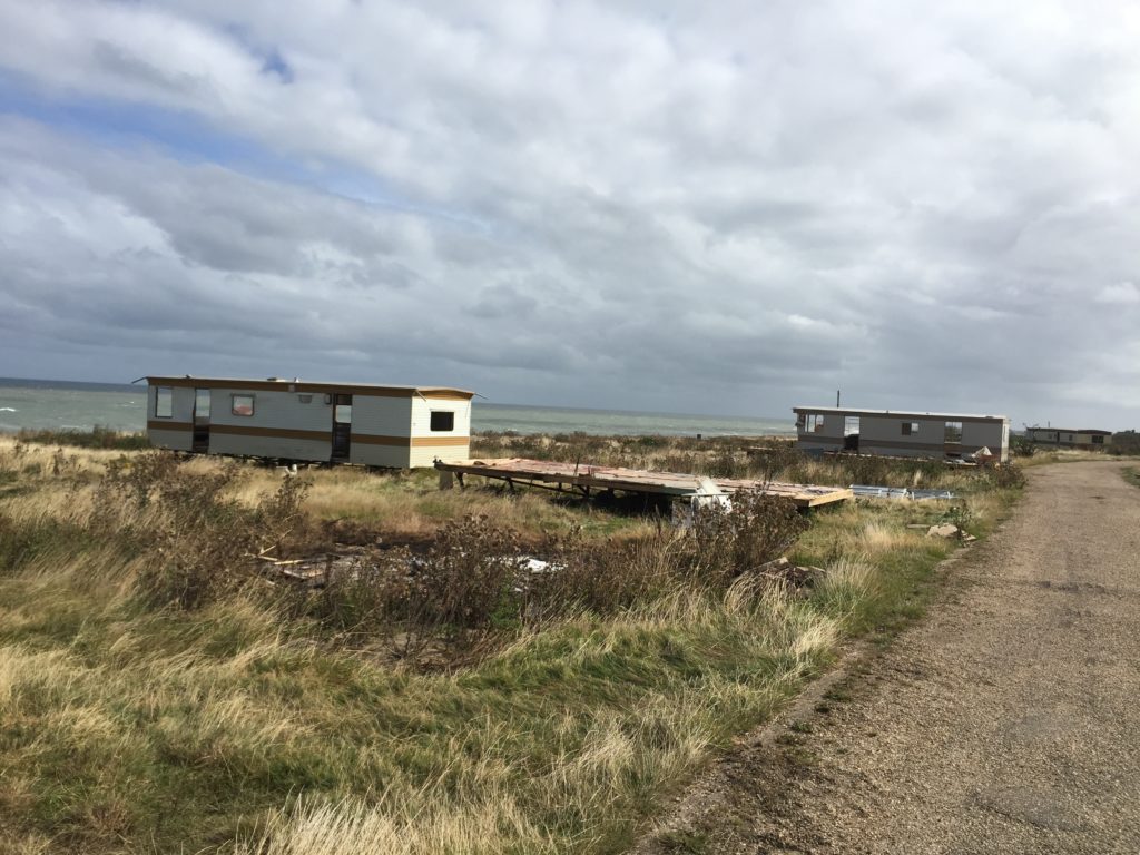
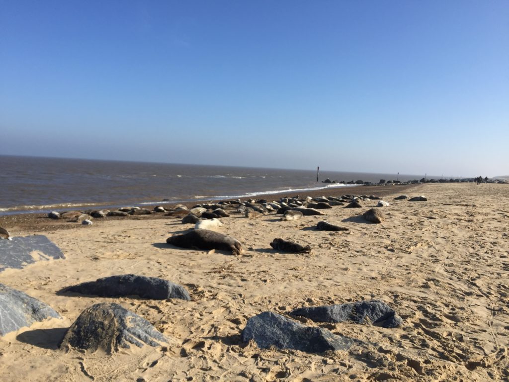
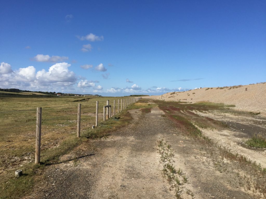
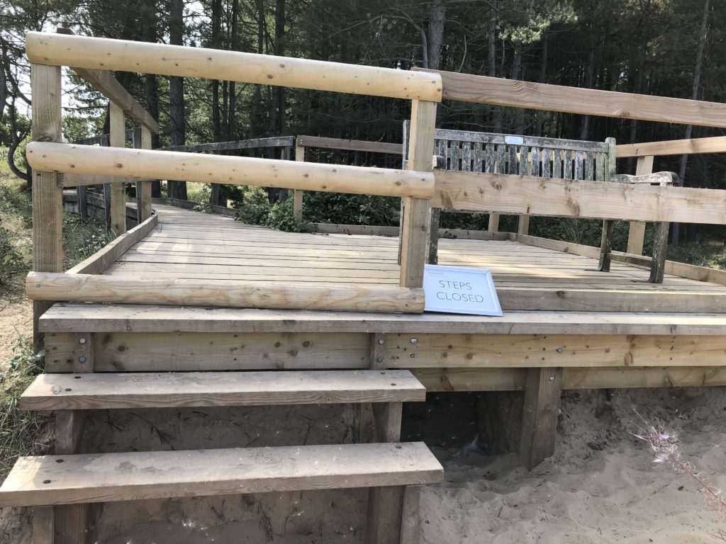
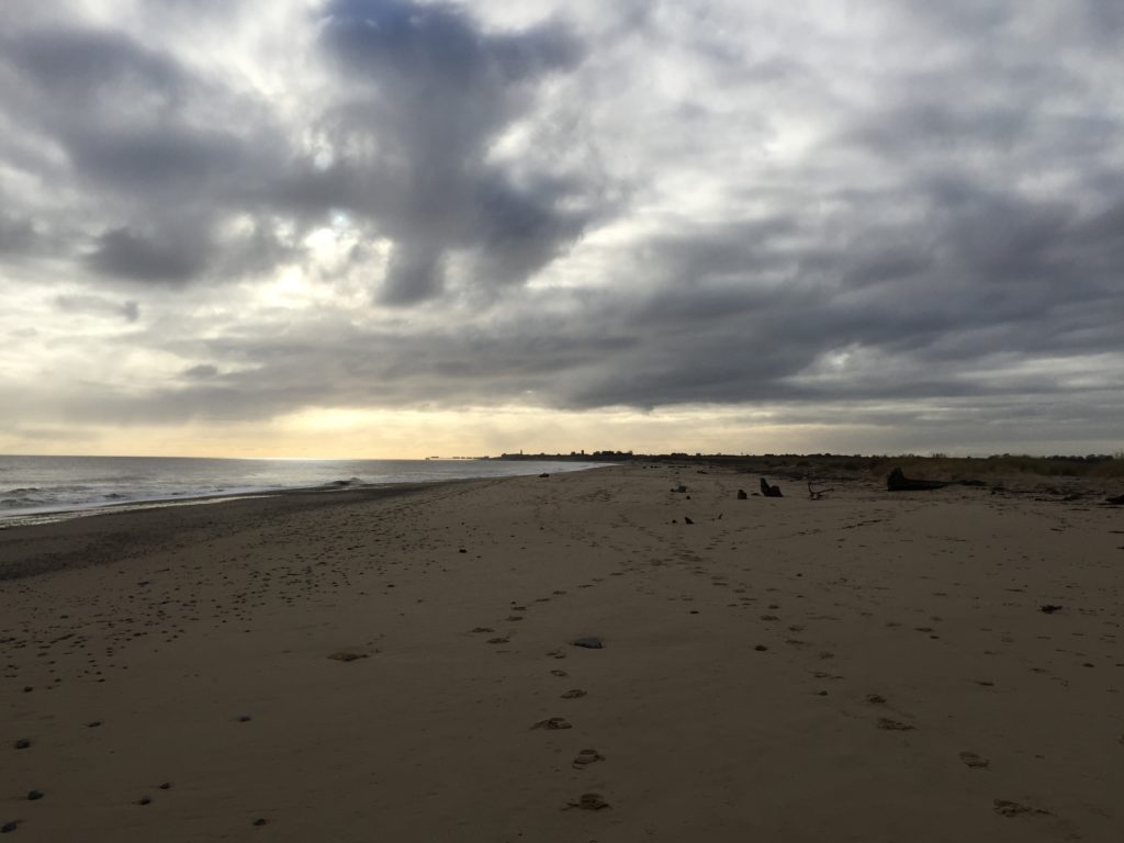
Past Jaywick the big moment has finally come: the caravan park I stayed at around 15 years ago.

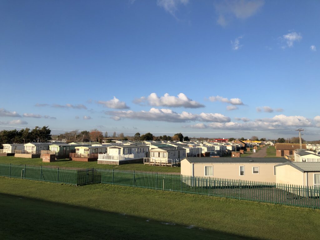
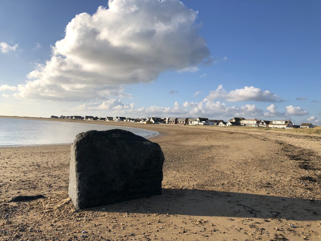
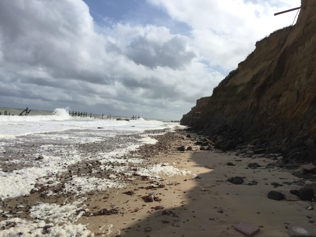
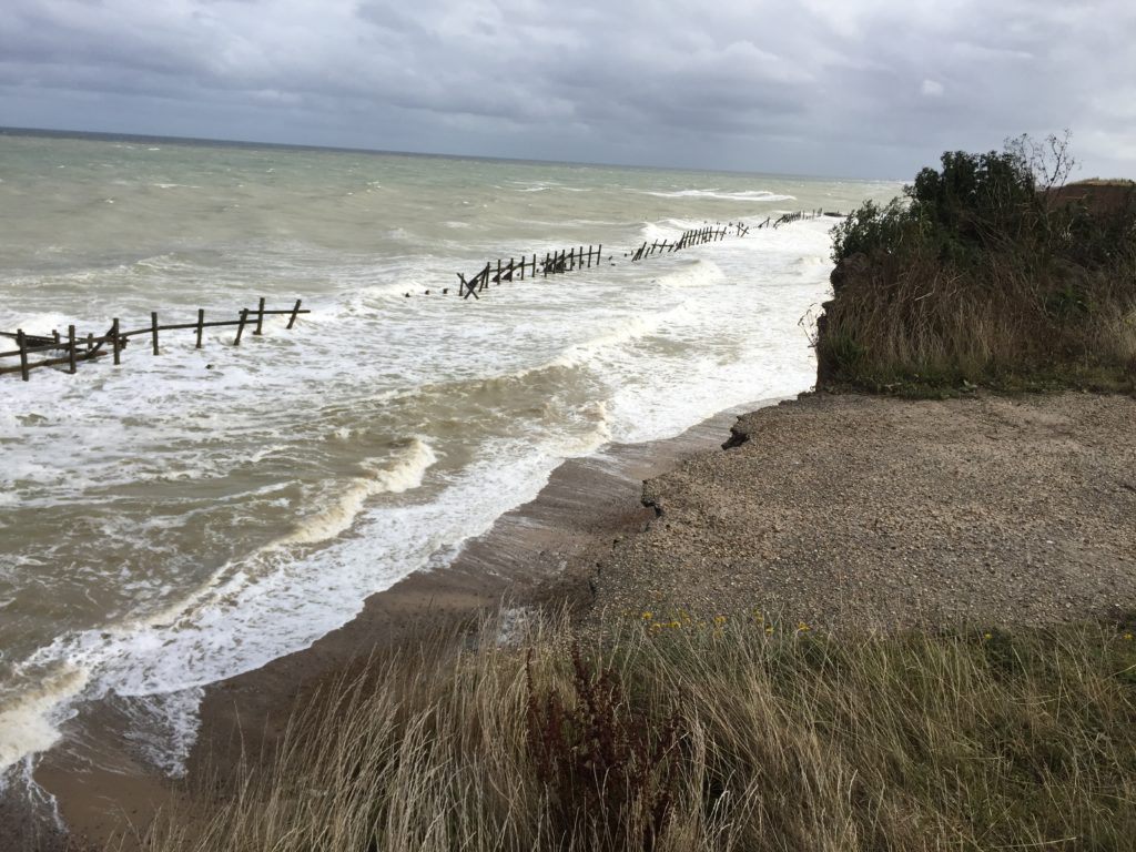
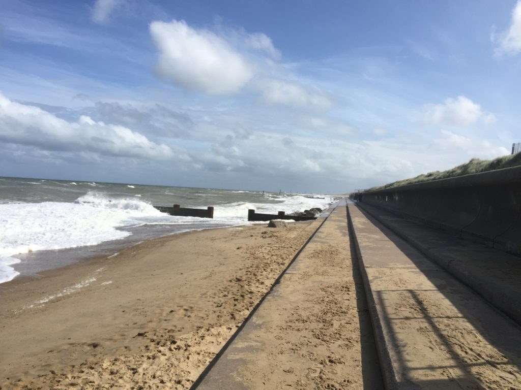
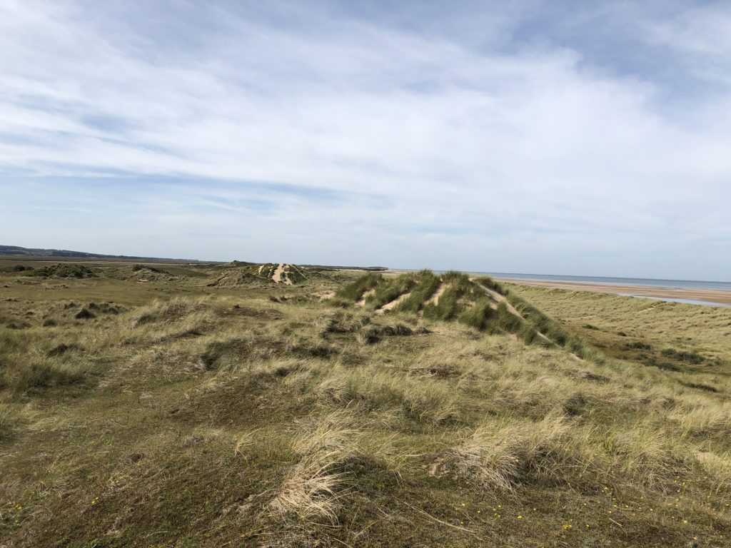
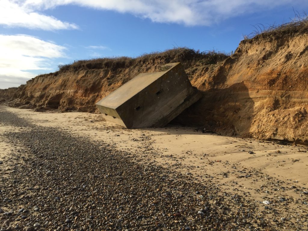
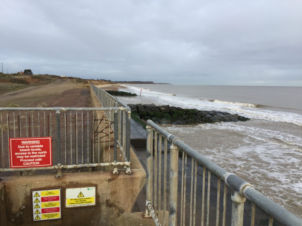
When I visited my parents last Christmas I rummaged around the attic in order to see whether any picture taken on the school trip have been preserved. Sadly I did not find anything – it might well be that I had not taken a camera at all – and so I only have my vague memories to compare the current impression with. While the caravan park itself looks pretty much like any other, I do quite vividly recall the dark stone groynes from solitary walks along the sea wall.

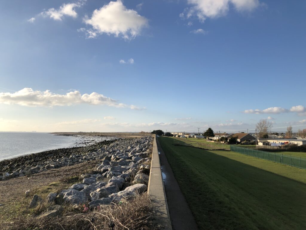
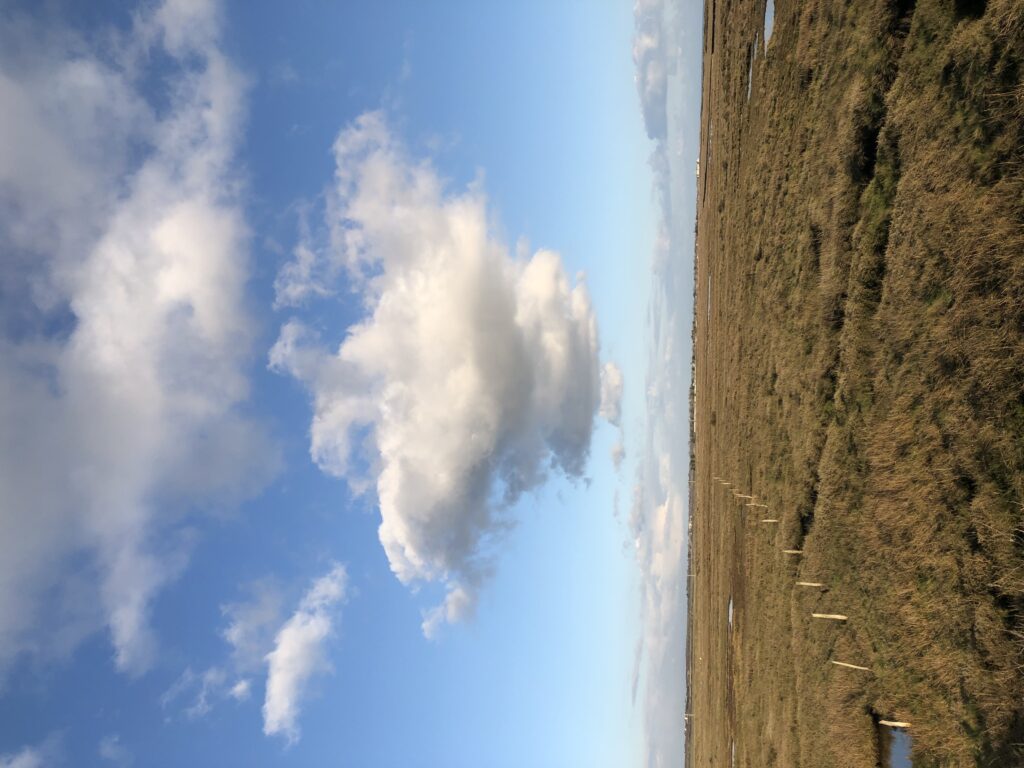
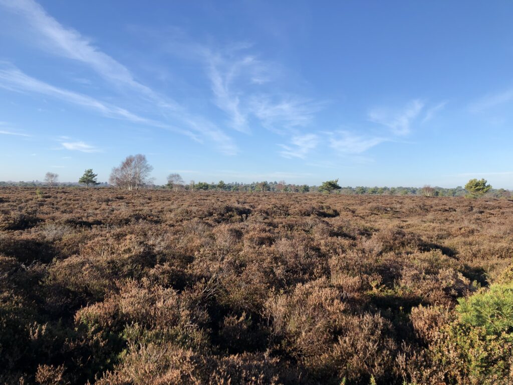
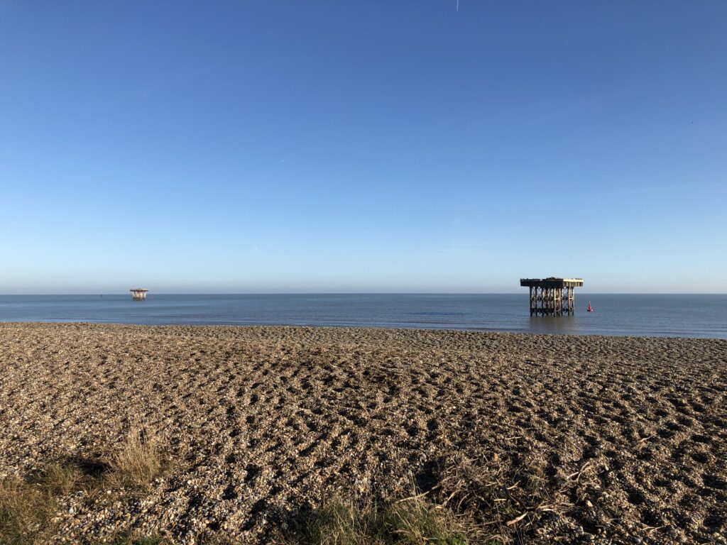
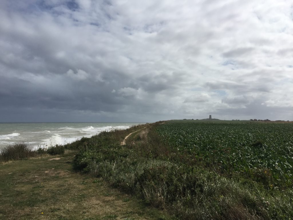
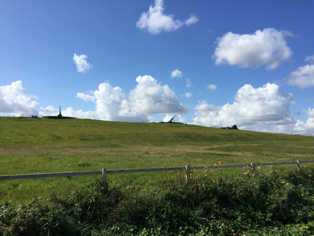
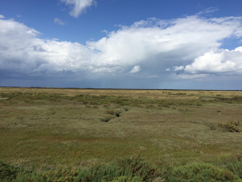
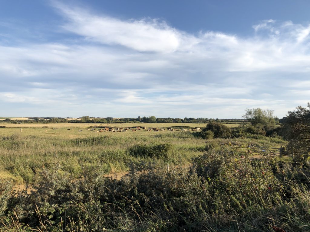
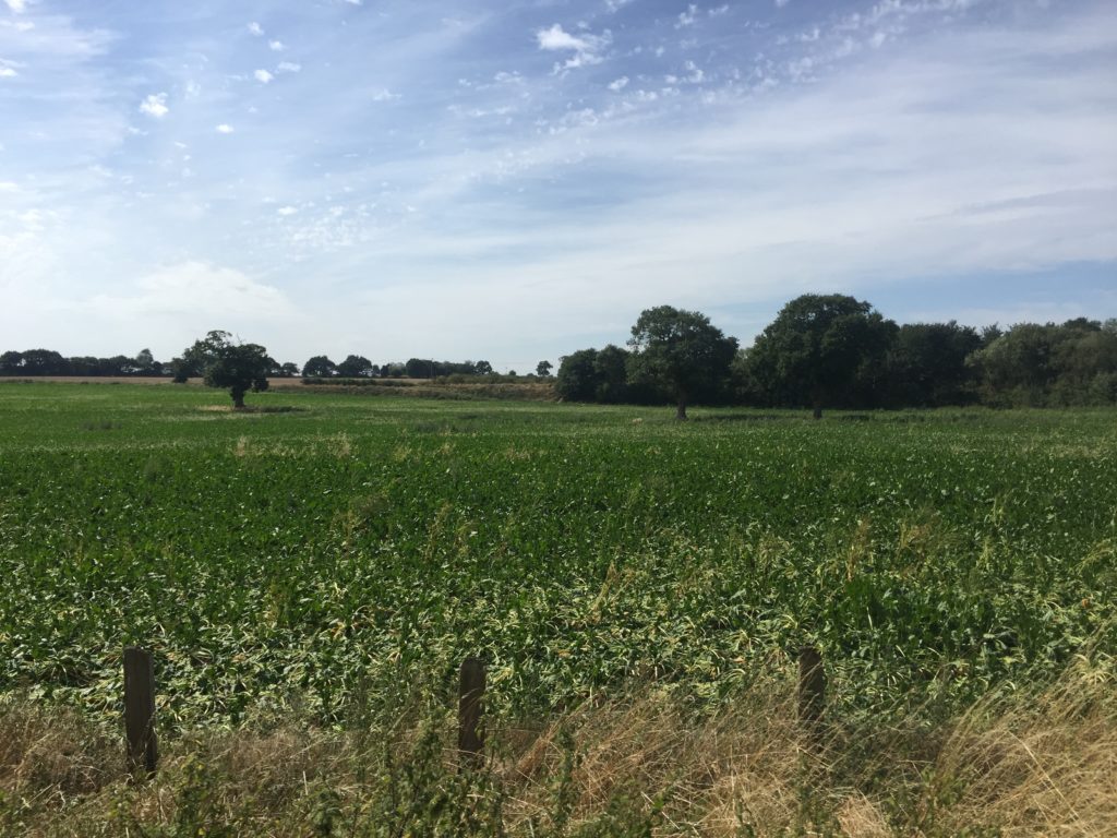
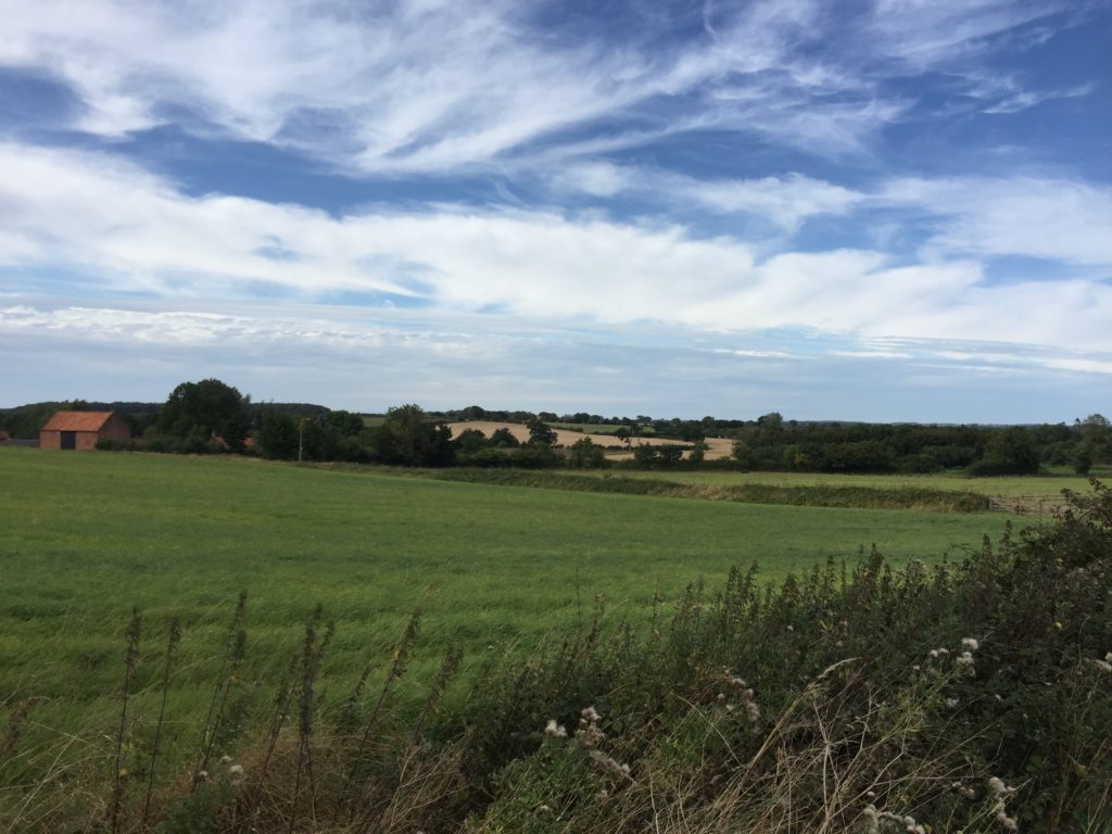
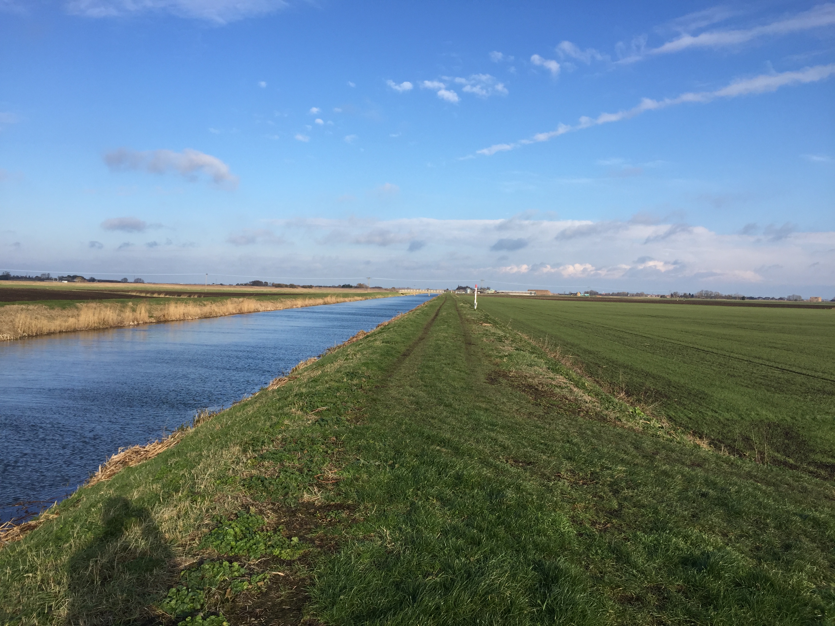
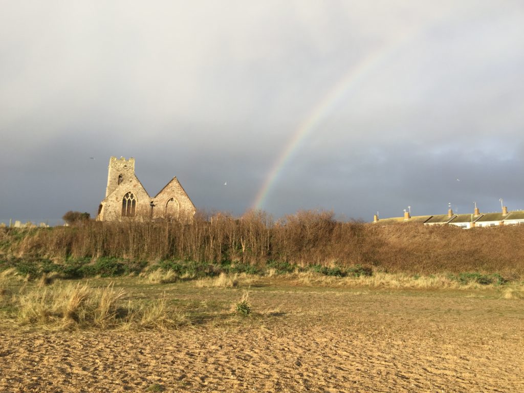
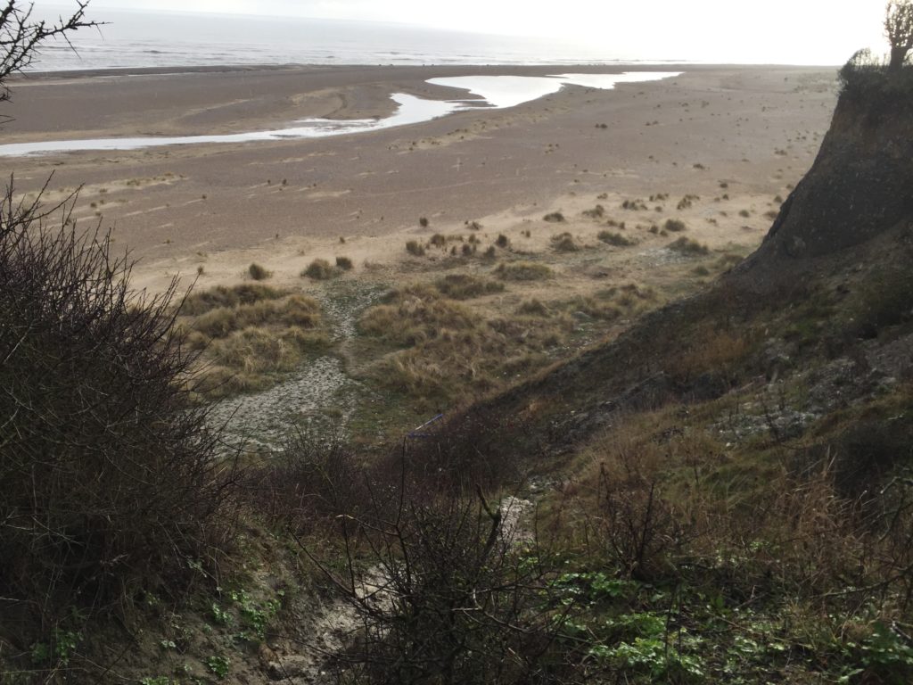
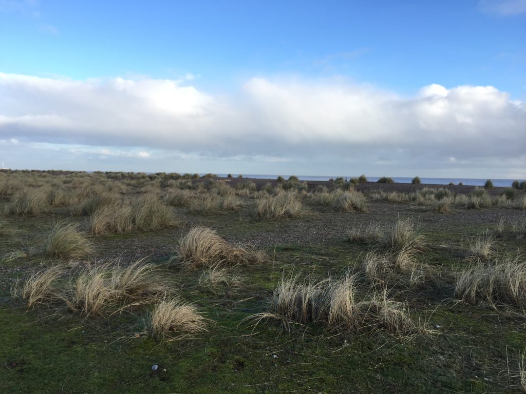
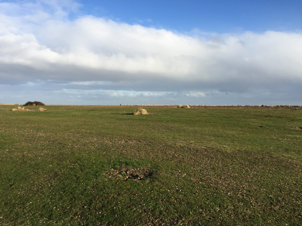
Beyond the caravans the salt marshes begin, and my visit to the past ends under a wide and open sky.

Suffolk Coast (Part 3)

It has been a while since the last report on East Anglia proper, but I have not been completely inactive. In September 2020 I completed the Norfolk Coast Path by walking the last two missing stretches: from Winterton to Great Yarmouth, following the footsteps of Robinson Crusoe, and from King’s Lynn to Hunstanton. Most of 2021 was then spent on the continent. Ever since starting this project in early 2019, I had wanted to continue walking the Suffolk Coast Path, in particular the route from Southwold to Aldeburgh. I put this off many times because, due to the lack of public transport in this area, one has to stay overnight, and accommodation tends to be pricy. Early January 2022, however, seemed an excellent time to finally go ahead with the plan.

After taking two trains and a bus I arrived in Southwold in the late afternoon. It was a rainy day and the light was already fading. The extended period of darkness had an upside: I could thoroughly enjoy the lighthouse in action. It is more widely known through beer and the movie Yesterday, in which a temporary global power outage coincides with everyone forgetting about the existence of the Beatles. There is one exception: the Lowestoft-based protagonist of the film still remembers their music, which comes in handy since he is a so-far unsuccessful songwriter. He is hit by a bus during the power outage, and in this scene the Southwold lighthouse is shown as the electricity comes back on.

After walking along the beach in the dark for a while I started to look into dinner. Since this was the seaside fish and chips seemed the most sensible option. I got some and went to a pub to eat them with a drink. As it happened the only other guests at my hotel sat at an adjacent table, and they soon struck up a conversation. They were a couple from Bedford who shared my surname – which had led to confusion while checking in – and also knew Cambridge well. Eventually the question of what the best Cambridge pub is was brought up. This led to two other people joining the discussion, who were partly based in Cambridge and partly in Southwold. They had come to the pub to celebrate a major victory. After a protracted dispute that apparently lasted several years, one of them had finally been granted planning permission to build a greenhouse on the roof of his house.

Planning permission is a serious matter that can cause much frustration. A striking example is that of Fidler’s Castle. In the early 2000s, the farmer Robert Fidler wanted to build a Castle-like house on his land in Surrey, but was denied planning permission since the farm was on protected Greenbelt land. He tried to get around this obstacle by exploiting a loophole in the regulations. If a structure is built without planning permission and the local authority doesn’t object within four years, it is allowed to stay. Fidler thus built his castle and surrounded it with large haystacks so no one could see it. The haystacks were then removed after four years. But the local authorities were not impressed by Fidler’s creativity. They argued that hiding the castle made the four year period invalid. After a long legal dispute Fidler had to give in and the castle was demolished.

I had been lucky in selecting the date for the walk. The next day the weather had turned around and it was bright and sunny.

Like for many other people, my major source of inspiration for walking the Suffolk Coast had been W. G. Sebald’s The Rings of Saturn. In the book the walk is quite a gloomy affair. Robert Macfarlane, in the documentary Patience (After Sebald), reports that on his own attempt to retrace Sebald’s steps the weather was really nice as well. Consequently the experience was very different from that described in The Rings of Saturn. Too much sun is a good problem to have though, especially in January, and I therefore have no complaints.

I only recently learned that the cultural theorist Mark Fisher also wrote a number of pieces on East Anglia. An especially interesting one is this rare show of dissent against unreflective Sebald-fandom. One of Fisher’s criticism is that Sebald is insufficiently receptive to the Suffolk landscape, in the sense that he merely projects his own concerns into it and could have written the same book about any other area. Another criticism is that Sebald doesn’t engage with previous attempts to make literary sense of East Anglia. One key example of this omission are the stories of M. R. James.

James was a medievalist at King’s College, Cambridge, who also wrote ghost stories. Many of them feature somewhat absent-minded academics, and two of the most well-known ones – Oh, Whistle, and I’ll Come to You, My Lad and A Warning to the Curious – are set in Suffolk. I originally came across James’ stories when I went to Felixstowe for the first time, because it is the setting of Oh, Whistle. (Coincidentally, on a more recent visit, I saw one of the people from the pub in Southwold striding along the seafront). A Warning takes place in Aldeburgh, the destination of my current walk.

The protagonist of Oh, Whistle is a professor called Parkins, who, while on holiday, finds a whistle with a mysterious inscription. After blowing the whistle twice he starts to have disturbing dreams and feels like he is being followed. Things only get worse as time passes. One night he wakes up and sees the sheets of the second bed in his room moving around on their own. He is saved, so one can assume, by a concerned friend who enters the room. In the end the whistle is thrown into the sea.

The BBC adapted this story, as well as A Warning, for television. In the TV version Parkins’ character is strikingly different from the story. James describers him as a young and confident professor of “Ontography”. In the adaption he is an older and extremely awkward professor of philosophy. Fisher’s last book, The Weird and the Eerie, contains an illuminating essay in which he calls the TV-Parkins  a ”crumbling logical positivist”, who, “in the manner of A.J. Ayer, is wont to dismiss the concept of life after death as devoid of meaning”. There is something to this. During breakfast, another guest asks Parkins whether he believes in ghosts. Instead of giving a straight answer, Parkins worries that we do not really understand what believing in ghosts means, since it is not clear how their existence could be confirmed or disconfirmed. In this respect ghosts compares unfavourably with Australia.

A Whistle was adapted and directed by Jonathan Miller, who, as can also be seen from the Beyond the Fringe “Oxbridge Philosophy” sketch, was clearly well acquainted with the British philosophical scene of the 1950s. Parkins uses jargon such as “grammatical appearance of a real question”, “logical difference of usage”, and keeps asking whether “we would want to say” this or that in various imagined scenarios. In this respect Parkins’ breakfast thoughts on ghosts are more in line with the stereotypes associated with the ordinary language philosophers in the wake of Wittgenstein, however, rather than the logical positivists. The more salient comparison is J. L. Austin, not Ayer.

The latter was not as dismissive towards life after death as Fisher’s quote suggests anyway. Already in the early Language, Truth, and Logic, Ayer grants that there are ways to understand this idea on which the hypothesis that life continues after death is perfectly meaningful, even though probably false. And he revisited this topic very late in life, in response to a near-death experience caused by a piece of smoked salmon that “went down the wrong way“. For Ayer the biggest problem with ghosts concerns personal identity. He thinks that one cannot explain the identity of people over time without recourse to their bodies. Since ghosts have none, no such explanation is available. Does this consideration, if sound, show that ghosts are impossible? It seems so, provided that it is essential for a ghost to have once been a person. Creatures that interact with the world despite having no body, on the other hand, are not immediately excluded.

I arrived in Aldeburgh and watched the sun set. Since it was still the seaside fish and chips again seemed a sensible option for dinner, and I went to another pub to have them. This evening was more quiet than the last.

The east coast is the perfect place to watch the sun rise, and so I got up early to do this before breakfast. As I was watching an old lady cycled past me, stopped not too far away, and went for a swim in the sea. Within the next half hour three more old ladies came along and joined her, plus an additional one to watch the proceedings. The latter told me that they do this every day, and asked me whether I would join. I politely declined, citing my lack of bathing trousers.

Hertfordshire Wanderings

In the autumn of 2019 I went on a number of short walks in the south of the county of Hertfordshire. I found this area appealing since even though it was still the countryside the border to Greater London was close by, and I would frequently encounter the M25 motorway. One of my rambles even followed the very first section of the M25 that opened in 1975, from Potters Bar to South Mimms. Towards the beginning of this walk I had to cross a stream using a slippery fallen tree trunk, which added to the general excitement.

Other Hertfordshire highlights were curious cows, a creepy cornfield, an air rifle shop called ‘Diversity’, and me learning that Stevenage is the UK’s space city.

The most memorable of these walks was longer and started in a more central part of Hertfordshire though. I had developed the desire to visit the city of Watford, which is not easy to explain since it is not generally considered to be a tourist attraction. Maybe the source of this fascination lay in the idiom ”north of Watford”, although it is disputed whether the Watford that gave rise to it is actually the one in Hertfordshire.

I had also never been to St Albans which, on the other hand, is generally regarded as an acceptable sightseeing destination. I thus reckoned that I could go on a walk that includes both cities. And this seemed feasible in practice as well, by starting in Hatfield and stringing together the Alban Way and the Abbey Line Trail. So off I went.

The Alban Way is a hiking and cycling trail that follows a former railway line. The walk began pleasant and uneventful until I noticed a sign indicating a ghost railway station:

Naturally I was very intrigued by this, and reality didn’t disappoint. Volunteers had rebuilt the former railway station Nast Hyde Halt in a lot of detail, with everything being in place apart from actual trains:

Signs warning about passing ghost trains were found along the way as well. This was a pleasant surprise, which made me glad I had chosen the Alban Way. (Pictures of the original railway station can be seen here.)

Eventually I arrived in St Albans, and had my lunch break next to the impressive cathedral. It turned out that St Albans had lot to offer: an ‘almost unique’ clock tower, a pub reputed to have accommodated Oliver Cromwell during the civil war, and some remains of the ancient Roman city of Verulamium. The latter brought back some childhood memories, for we used to go on family trips to former Roman towns in Germany, such as Trier or Xanten (the only German city whose name starts with an ‘X’). Not much of Verulamium has remained apart from a couple of stone walls, but walking around the grounds was enjoyable nevertheless.

Thanks to these attractions I had spent way more time in St Albans than anticipated, and so continuing all the way to Watford seemed rather ambitious now. I nevertheless started to head south, as the route was parallel to a working railway line, which would enable me to end the walk early if desired.

After leaving the suburbs of St Albans behind things got adventurous very quickly. As there had been a lot of rain in the previous days the ground was wet and muddy.  In addition there was a junction with a mind-boggling number of signs pointing in all directions, but the footpaths corresponding to these signs were less easy to make out.

I managed to find the right path, but the mud was a more severe problem, as it only got worse along the way.

Progress was slow and my feet were wet. I therefore decided to call it a day at the next railway station – Park Street – and take the train to Watford. This was not too disappointing, as Park Street is the least used station in Hertfordshire. Furthermore the last mile was mud-free and very scenic.

The Abbey Flyer between Watford and St Albans is a cute branch line with only a couple of stops and a very unusual service frequency: the train departs every 45 minutes rather than hourly or half-hourly, which I have not encountered anywhere else so far.

Eventually I thus made it to Watford by rail, where I walked around for a while before making my way home via central London. My impression was that the protagonist of Jonathan Coe’s novel has a point when he says that while Watford is alright, it is not like ”living in Watford, you wake up every morning and think to yourself, Well, life may be a bit shit, but look on the bright side, at least I’m in Watford.” I might come back for further investigations though.

The Wild Side of Norfolk

This entry concludes my three-part series on the Norfolk Coast Path, and I will describe the less popular section between Mundesley and Winterton-on-Sea. It is apt to describe this eastern route as the wild side of Norfolk for two reasons: first, the sea here is much rougher than in the quiet north of the county, and hence many coastal villages are threatened by erosion. Secondly, while in general the Norfolk coast is well served by public transport (especially compared to the Suffolk coast), there is virtually no bus running between Mundesley and Winterton-on-Sea (technically there are a few buses to Happisburgh and Sea Palling on weekdays, but not at times convenient for walkers). These 15 miles thus need to be walked in one go.

I took the train to North Walsham and made the very tight connection for the bus towards Mundesley. I had been there before in order to walk in the other direction to Cromer, which was very scenic:

Since then several instances of coastal erosion have been reported in the news, however, so I am not sure whether the route I took then is still possible. At various points the path had been quite close to the edge of the cliffs.

I also anticipated issues with the Norfolk Coast Path east of Mundesley, since I had read about a diversion due to a novel and extensive sandscaping scheme. It seemed that the work on the beach around Bacton had already been completed, however, since I did not encounter any closed sections on the way.

For the first few miles the path is on or right next to the beach, and I did not pay too much attention to the map. This proved to be a bad move, however, for I missed the spot where the coast path turns inland. Instead I continued to walk along the beach, which got narrower and narrower.

Eventually I could walk no further – the tide was also rising – and it dawned upon me that I must have made a mistake.

I checked the map carefully and indeed, I should be on top of the cliff instead of the beach. I felt unenthusiastic about walking back the last few miles, however, since walking on the sand was not that enjoyable. I thus seriously considered trying to climb the cliffs, but quickly abandoned this project on account of being dangerous and foolish.

There was thus no choice but to double back, and eventually I reached the official path at Ostend Gap.

I really enjoyed this part of the walk: there were roads leading and signs pointing nowhere due to land being lost in coastal erosion. In addition, several abandoned caravans, together with high waves hitting the cliffs down below, created a unique atmosphere.

I then arrived in Happisburgh, which has a very nice lighthouse that can be seen in the header image. The pronunciation of the name of this village is surprising: Haze-bruh. Walking on the cliffs continued to be thrilling:

At some point the coast path rejoined the beach, however, which was worrying. The tide was at its peak now, and from where I was standing I could not make out whether walking on the beach might not lead to a dead-end as before.

In light of the earlier experience I opted for the safe but slightly boring alternative inland route. In hindsight this might not have been necessary, as I saw some dog walkers who seemed to have made it on the beach route.

Eventually I re-joined the beach which had gotten much wider at that point. In the distance I could see some of the nine coastal defence reefs which were built in the 1990s to protect the village of Sea Palling.

After Sea Palling the path leaves the coast and continues behind the dunes, which made this part of the walk less exciting, apart from some oddities on the way.

I walked quite quickly and had soon reached Horsey Gap, which is famous for its seal colony. (There’s also a good windmill nearby). I had already been here on an earlier occasion to look at the seals, and this time I followed the official path instead of going back to the beach. This was because I had planned to have a coffee break at Winterton, but time was tight because of my unplanned extension of the walk earlier that day.

Once again I just about made it before the cafe closed, and sat down for the first time in a long while.

Originally I had wanted to continue from Winterton to Great Yarmouth in order to complete the Norfolk Coast Path, which is another 9 miles. But since I arrived much later than anticipated and was also more exhausted, I decided to cancel the last stretch. This is sad because I have not been able to walk this last bit – which plays a role in Robinson Crusoe – yet, and will not be able to do so in quite a while. Another trip to Winterton is thus on the todo list for 2020.

North Norfolk Double Feature

In this entry I will cover what is probably the most popular section of the Norfolk Coast Path: the route from Sheringham to Hunstanton via Wells-next-the-Sea. I walked it in two parts, the first half immediately following my walk from Ayslham to Sheringham, so let us start there.

I did not sleep particularly well in the youth hostel and my feet slightly hurt from the previous day, so overall I felt a bit groggy. Luckily there was a cooked breakfast and the day was beautiful, so I nevertheless started the walk in good spirits. I was soon richly rewarded, for west of Sheringham the coast path is on the cliffs and provides some spectacular views.

The steam train in this picture is the North Norfolk Railway heading to Holt, which I have used on a previous occasion.

After the cliffs end the paths goes along a beach, from which one can see several anti-aircraft guns up a hill. They are part of the Muckleburgh Collection, a large military museum.

Soon afterwards the terrain started to change, and a massive shingle mountain appeared on one side.

I avoided walking on the shingle as far as I could, but soon there was no alternative.

The shingle was loose, so that each step was hard work and my progress became excruciatingly slow. I assumed that this would only be temporary, but after I had walked on shingle for half an hour I began to suspect that things would continue in this manner for a couple of miles, until the next village. This turned out to be nearly correct, for I luckily managed to find an alternative and much more pleasant footpath for the last mile.

This unpleasant experience made me wonder whether I had missed the route of the official Norfolk Coast Path at some point, but it turned out that the shingle hell is indeed the intended way. Since others have also not enjoyed this part of the walk very much I later found a proposal for a shingle-free detour.

I had now made it to the village of Cley-next-the-Sea, which is pronounced “Clay” and has a nice windmill. I have been wondering about the “-next-the-Sea” suffix, which – unlike the popular “-by-the-Sea” – only seems to be found in Norfolk, but have so far been unable to find any explanation of why this is so.

From this point on the walk became much less eventful, with the landscape for the most part looking like this:

One of the villages on the way is worth mentioning: in the first half of the 20th century Stiffkey famously had a rector who, after an eventful life and career, ended up being in eaten by a lion in Skegness.

Towards the end of the walk I became quite tired, and was pleased when I saw Wells-next-the-Sea appear on the horizon. I arrived there just in time to take the Coastliner bus to King’s Lynn, although the bus driver did not seem very enthusiastic about having passengers. After stating where I wanted to go he responded by saying “You know that you’ll be on this bus for three hours?” (this was repeated to other passengers as well), and pointed out that it would have been faster to take another bus which had left a minute ago. Despite the leisurely pace I enjoyed the scenic journey.

Two weeks later I was back in Wells, in order to tackle the ~22 miles to Hunstanton. Remembering the bus driver’s advice I did not take the Coastliner to get there this time, but the slightly faster route from King’s Lynn which involves changing buses in Fakenham.

Right to the west of Wells is one of the most scenic parts of the Norfolk Coast Path: Holkham Beach, which has appeared in various films and TV shows. It is hence a popular tourist attraction, but once I had moved away from the parking lot I was pretty much on my own:

After Holkham the walk continued to be pleasant but – as the second half of the first stretch – relatively uneventful. Even though it doesn’t quite fit I will use this occasion to insert a picture of a typical Norfolk flint house:

At the village of Brancaster the official Norfolk Coast Path takes an inland diversion away from the coast, which I felt unenthusiastic about. I had done some research in advance which suggested that there is the possibility to walk along the beach instead, however it was not clear whether this route was still passable due to a very recent breach of the beach. I was tempted to just give it a try, but ultimately decided against it because any delay would have meant walking in the dark or terminating the walk early.

After passing this signpost I had nearly reached my destination, and I approached Hunstanton walking on the beach. In an earlier entry I suggested that Hunstanton is not very nice, a statement I now would like to officially retract: the cliffs alone (of which I had been unaware on the earlier occasion) make it well worth a visit.

Another excellent feature of Hunstanton is that it is one of the very few places in the east of England from where there is water to the west, which is ideal for watching the sunset.

Unfortunately I failed to properly use this opportunity since I was hungry after the walk and tried to get some food, but long queues everywhere stopped me both from eating and from seeing the sun set. I regretted this on the bus back to King’s Lynn, but otherwise the walk had been a very enjoyable experience.

Towards the Coast by Steam and Foot

In September this year I went on a couple of walks in Norfolk, with the ultimate ambition to walk the whole of the Norfolk Coast Path. I had done small bits of it before (see here and here), and since the days were long the late summer seemed the ideal time to tackle this project. Ultimately I did not quite succeed, and there remains a 9 mile stretch of the path I have yet to walk, for reasons that will be explained in a later entry.

In order to kick off this undertaking I decided to go on a two-day walk with a stay in a youth hostel in between. This allowed me fit in another item on my to-do list, namely to take the Bure Valley Railway from Wroxham to Aylsham. This is a narrow-gauge steam railway whose one terminus is connected to the national rail network, whereas the other end is sufficiently close to the coast to walk there. This was ideal for my purposes, and so I booked a ticket.

When I arrived in Wroxham there was still a good deal of time left before the steam train would depart, so I strolled through the village.

It is pretty and popular with tourists who want to explore the Norfolk Broads. While looking at the local shops I found that  it is possible to rent small motorboats here without any boating or driving licence, which I found surprising and intriguing. I ended up trying such a boat a couple of weeks later when C. visited, and it was indeed fun even though they are very very slow. My proudest moment on that trip was when I had to reverse into the parking area of a riverside pub with the boat.


For now it was time to take the train though. I had never been on a narrow-gauge railway before, which is half the size of a regular train, and the carriages did look tiny when they drew in.

The train was very popular with families, where in many cases the parents appeared to be much more interested in the proceedings than the children. One father (who looked a bit like David Cameron) started to chat to the engine driver, and was clearly pleased when he could correctly name some of the components of the engine. I could sympathise with this excitement, and soon we started to head north. The ride was quite bumpy but enjoyable, with some nice views of the typical Norfolk countryside.

After arriving in the town of Aylsham I ate a sandwich for lunch in the shadow of the church, in order to be ready for the ~17 miles to the coast. This stretch is the northern end of the Weavers’ Way, whose southern terminus is Great Yarmouth.

After sitting on various trains for several hours I felt full of energy and made swift progress. I soon passed Blickling Hall, one of the two stately homes on this walk. I did not pause here to have a closer look because I wanted to save time in order to reach the other stately home – Felbrigg Hall – before closing time. This was partly in order to have some tea in the late afternoon, but also because the latter was home to Wyndham Ketton-Cremer, who was known to be a great Norfolk enthusiast. I had brought his book “Forty Norfolk Essays” with me, which contains various Norfolk anecdotes from throughout the centuries. One I still remember concerned a local clergymen who became the target of vicious gossip for being too fond of custard, for instance.

The footpaths I walked along were pleasant and free of obstacles, apart from some cows blocking the way. The landscape here even featured some gently rolling hills, and I came across a church with an unusual round tower.

While walking along a country lane I encountered a sign that said “Slow You Down”, which struck me as rather unidiomatic (even though I’m not a native speaker). I later learned that this is an instance of the local Norfolk dialect, and apparently a number of other Norfolk villages have started to put up these signs as well.

Shortly afterwards I passed through the tiny and quaint village of Hanworth (not this one), where a village fête was in progress. Nearby I saw this milk box, and I couldn’t walk on without checking whether it contained any milk bottles (which it did).

As mentioned before my plan was to have some tea at Felbrigg Hall, where the café closes at 4pm. I had lost some time after taking a wrong turn due to not reading the map carefully enough at one point, so I started to doubt whether I would make it. I increased my walking speed for the last mile and just about succeeded, ordering my tea 10 minutes before closing time.

The Weavers’ Way I had been following leads to Cromer, but my intended destination was Sheringham, where I had booked the youth hostel. After Felbrigg Hall I thus left the Weavers’ Way to follow some unnamed footpaths to the coast. This was more adventurous than anticipated, for one of them led me through a variety of fields with different crops, and with each the actual path became harder to spot:

I ended up in a woodland with so many different paths that I lost track of where I was, so I walked in the direction that intuitively seemed correct. This worked surprisingly well, and I eventually arrived on Beeston Regis Heath, from where I could see the sea for the first time.

By now I had walked more than the 17 miles I had anticipated, and so instead of continuing all the way to Sheringham I went to West Runton railway station to take the train for the last few miles. After checking in at the youth hostel I was very hungry, and went into town to get some fish and chips. There were various shops, but while most were completely empty one was crowded and full of people, so I trusted the instinct of the the masses. I did not regret this decision, and enjoyed my dinner while watching the sunset at the beach.

In the Home Counties

The summer has been quiet, but I have been going on some long walks in Norfolk recently, so soon there will be East Anglia content again. Before that I want to end the series of special posts in which Usedom and Scotland were covered with some notes on a walk in Berkshire I did earlier this year. (The title of this post is thus slightly misleading, as only one Home County makes an appearance).

In a sunny week in spring I for some reason felt like going on a walk which included attractions with more mainstream appeal than those I usually visit, and therefore decided to walk from Ascot to Windsor. It takes a while to get there from Cambridge, but since I always enjoy taking a train from Waterloo station the journey didn’t put me off. I had also considered to start the walk in the suburb of Martins Heron, which is one station further down the line from Ascot, as it was used as the location of the Dursley’s house in the Harry Potter films. Although I decided against this plan in the end, I came across a long and detailed article about where the fictional town of Little Whinging is located within Surrey, which is brilliant as it even manages to come up with a plausible explanation of how the protagonists in the fifth volume manage to reach central London by heading southeast.

The butcher in Ascot seems to be famous, as there was a large queue leading out to the street when I walked past. I headed for the even more famous racecourse, however, and it turns out that it is actually open to walkers on non-race days.

By now I had been walking for about 30 minutes, and realised that the sun was very strong but I had no sun protection. I therefore decided to quickly walk back to the High Street – where the queue at the butcher was still long – in order to buy sunscreen (since then I have also acquired a hat for unusually hot days). Having done this the actual walk could now begin.

I followed some public footpaths which led me to the entrance of the massive Windsor Great Park (2,020 hectares). From here my first destination was Virginia Water Lake, which I thought had inspired a song by Roxy Music, but later it turned out that I misremembered and the name of the song is actually “Virginia Plain”.

Unusually for my walks there were masses of other walkers around this time. I had expected this and feared that it might be annoying, but apparently few people venture more than 15 minutes away from where they parked their car, and so apart from a few clusters most of the park was actually surprisingly empty. The number of dogs probably even superseded the number of people, some of which had quite unusual names such as “Dustbin” or “Nutmeg”.

Near the lake there are some nice gardens and a very peculiar pole. I ate my sandwich for lunch, fascinated by the elaborate picnic arrangement of some groups, which reminded me of one of my favourite The Avengers episodes: on a train John Steed announces that since there is no restaurant car him and Emma Peel have to “rough it”, and proceed to unpack a small table, porcelain cups with saucers, different kinds of loose tea in a wooden box, and so on. (I already mentioned this particular episode before – I have seen others too though!)

After this break I started to head north to get to the beginning of the so-called Long Walk, which runs in a straight line between Windsor Castle and the Copper Horse – a statue of King George III.

The view from here, which can be seen in the header image, is really spectacular. Straight ahead there is Windsor, and to its right lies Heathrow Airport, so one can watch planes landing and departing in rapid succession.

Although I took many pictures of Windsor Castle from the distance, I unfortunately failed to take any good ones when I was closer to it. On the other hand I quite like the following picture of a pub:

The town of Windsor itself is pretty, but hopelessly overcrowded – compared to this the centre of Cambridge on a weekend, which is already pretty bad, can count as quiet. I thus decided to minimise the amount of sightseeing I do in the town, and just had a brief look at Eton on the other side of the Thames.

No surprises here: Not only the crowds of people are similar to Cambridge, but also architecture and terminology (there was a sign indicating where the “Porters’ Lodge” is):

Windsor has two different railway stations: one by Great Western Railway, from which a shuttle train runs to Slough, and second one by South Western Railway, from where trains go all the way back to Waterloo. On a previous occasion I had walked to Slough and caught the train to Paddington from there. This time I headed back to Cambridge in a less idiosyncratic way.

The Ascent of Ben Vrackie

I recently visited my friend X. in Scotland and wanted to use this opportunity to climb up a hill, in order to see how that compares to the flatland walking I usually do. I have lived in Scotland myself for a whole year but did little walking there. The reason for this was that although I had bought hiking shoes before moving specifically to get into walking, these shoes had no ankle support, and unfortunately I discovered after arriving that the local walking club demanded shoes with such support – so I could never join them. In East Anglia this was not necessary though, and so I started going for walks only after moving away from all the hills.

I lacked the local knowledge when planning the trip, but luckily there is a very good database for the Scottish Highlands. X. and I thus decided to climb Ben Vrackie, as this can be done easily using public transport by taking the train to Pitlochry. To get the most out of the day we got up early to catch one of the first trains, but unfortunately this was cancelled – X. luckily checked before leaving the house, and so we could extend our breakfast. Things did not go so smoothly after that either: On the platform at Perth there was large crowd of (partially quite disgruntled) people waiting for the train to Pitlochry (and Inverness), and the dot-matrix indicator displayed the unpromising message “This train is formed of two coaches – Standing room only”.

Naturally this made us concerned about not fitting into the train at all, but miraculously nearly everyone managed to squeeze in. The journey not very comfortable and the train crew were extremely apologetic about the whole situation, but in the end we successfully made it to Pitlochry. The walking could thus begin.

The way to the top of Ben Vrackie can be divided into two stages: The first part leads one from Pitlochry (which is around 150m above sea level) to a lake called Loch a’ Choire at 523m, and – even though I have never experienced anything like it during my travels in East Anglia –  the incline here is relatively gradual. The second part, leading up to the 841m high summit, however, is much steeper and presumably qualifies as hillwalking proper.

The height was not the only thing that made this walk unusual. Scotland’s colour scheme is very different from that of (the south of) England as well, with lots of brown and other dark tones dominating. Furthermore there were many other walkers, roughly two-thirds of which also seemed to be German, whereas on the flatland walks I do one hardly meets anyone apart from a few dog walkers. And finally the wind was pretty strong and cold, so I can now see why many people like hats, scarves, and so on. (I did not get ill though despite lacking all the equipment!)

As we reached the lake and prepared ourselves for the final stage of the ascent the wind became considerably stronger, which made the climb to the top quite the adventure. We did eventually reach the summit though, where the views were spectacular (and there was even some snow).

At this height the wind was so strong that it felt like we might be blown away any second, and I had to hold my glasses because I was afraid that the next gust might send them down the mountain. Since this made staying on the summit rather unpleasant we started to climb down again soon after we had taken an appropriate amount of pictures, although at times we had to stop because the wind made it impossible to move in the direction we wanted to go. Overall the way downhill appeared surprisingly long, and I was thus very impressed with ourselves that we had actually managed to make it uphill.

Back at the lake we rested for a bit, and then decided that we had sufficient energy left to extend the walk some more. Instead of going back the way we came we headed west towards a village with the interesting name Killiecrankie, from where we would walk back to Pitlochry along the river Garry.

This part of the walk was much more relaxed as the decline was gentle, the wind had subsisted, and the valley we headed into looked pleasant and inviting compared to the mountain we were leaving behind.

Down by the river we walked south, with the railway viaduct carrying the Highland Main Line between Perth and Inverness beside us. Despite it’s important-sounding name the line is mostly single track, the service is less than hourly, and the travelling speed is relatively slow – which is why the cancellation earlier that day had caused so much chaos.

Luckily the journey back was more enjoyable, with all the trains being on time and having free seats. Back at X.’s place we ended the day by eating a very well-deserved fish supper.

My verdict in hillwalking is that it seems fun in small doses, but I wouldn’t want to climb a mountain like Ben Vrackie every week, for the day after my knees hurt so much that I could hardly walk at all.

Mysterious Fenland

I recently read Graham Swift’s Waterlandsaid to be the Great Fenland Novel. It is an interesting book, but the story is rather bleak: On just over 300 pages the reader encounters murder, incest, child abduction, an unwanted pregnancy which results in a failed abortion attempt, and several unhappy marriages. After finishing the book I was certainly in the mood for some more lighthearted fiction, but nevertheless I also wanted to go on a walk in the Fens.

I had been on a Fenland walk before: The March March march from March to Cambridge, which was a unique experience but mostly involved road-walking; and that I wanted to avoid this time. I therefore decided to walk from Whittlesea to March on the Hereward Way, which is named after an Ely-based 11th century nobleman who led a rebellion against William the Conqueror.

The day was cold but sunny, which is an ideal combination for this area. The first half of the walk consists of footpaths on dykes along various drains, and with no real change in the surrounding landscape this might have been a bit boring, but the sun shining on the ice made the experience pretty enjoyable.

The Fens are a strange place for sure. On the walk I heard the sounds of several dogs barking and howling loudly, but could not see a single dog anywhere – and obviously this was not because a hill obstructed my view. The sounds of the freight trains on their way to and from Felixstowe were also a constant companion, which can be enjoyed at home thanks to some enthusiasts on YouTube.

Unusual things had also happened on the aforementioned walk from March to Cambridge: After taking a picture of a (not very impressive) lake my phone mysteriously crashed and the battery was suddenly completely drained – something that has never happened before or since. Keeping this in mind I brought an external battery this time, which was not needed in the end though.

Eventually I reached the remote village of Turves, whose pub is a real-life instance of the Signs of Disrepair trope:

There was also a road sign which said “Park Here and Use Phone at Crossing”, which I was unsure what to make of. I still don’t know what the purpose of these signs is, since googling the phrase merely led to other people asking about their meaning without any conclusive answers. [Update: See Mark’s comment for an explanation.]

The character of the walk changed after passing Turves, and the at times very muddy footpath leads one through fields and farmland. Probably the most memorable moment of the day was encountering this creepy plastic tree shortly before leaving the village behind:

Eventually I reached the River Nene, where the Hereward Way continues along the bank until March. The footpath here leads directly through some people’s back gardens, from where I spotted two swans sitting between the ice:

Annoyingly a very short stretch along the river – just the area between the two gates – is privately owned, which necessitates a detour via a nearby road. 

As far as I could see this was not signposted, so the map I had bought for the walk was a worthwhile investment.

I approached the town of March from the west and walked past some very nice houses – I think the Fens would really benefit from more pink:

Overall the walk was much less bleak than the novel – but the weather helped, and I would only recommend it for those who truly have a taste for desert landscapes. There are other parts of the Fens I still want to see, but probably not all that soon.

Suffolk Coast (Part 2)

As Lowestoft is Britain’s easternmost place, it is where the sun first hits the island, and luckily the second day of my coastal walk indeed started out sunny.

After a substantial breakfast at the B&B where I had stayed the night I started to head south. In principle the stretch between Lowestoft and Southwold is part of the Suffolk Coast Path, however the official route is for the most part not actually along the coast, but has been diverted inland due to coastal erosion. It is however possible to walk along the beach, provided that the tide is low, and this is what I was planning to do.

Soon after starting the walk the sun was joined by scattered showers, which were fortunately not too annoying, and the combination gave rise to nice rainbows while I left Lowestoft behind.

This walk is clearly more popular than the one from Yarmouth, as I came across many other walkers on the way. By way of a greeting, a man who was walking his dogs pointed out that there had been lot of erosion recently, and indeed I saw even more debris than the day before, including a whole bunker:

After walking on the beach for a while I spotted a path up the cliffs, and went up in the hope that I would be able to walk along there for a change and get a good view. There was indeed a path which led past some fields, but unfortunately it suddenly ended in a steep muddy decline towards the beach: 

As I strongly dislike doubling back I cautiously tried to climb down, but quickly gave up this attempt as the ground was so slippery – it had started to rain more by then – that I would almost certainly have ended up falling into the mud. Grudgingly I therefore walked back to where I had come from and continued the journey along the beach.

Not much later I reached Kessingland, which is roughly the midpoint of the walk and whose beach is very wide and features stones and heathland:

This was one of the most enjoyable parts of the walk, since the unusual landscape made the whole area feel remote and mysterious. I recently watched an episode of The Avengers in which strange events take place on Holkham Beach in Norfolk, and Kessingland Beach would certainly also be suitable to create such an atmosphere.

Eventually I reached the narrow stretch of the beach which is only passable at low tide, and sometimes not even then, as there are a couple of lakes (called broads) inland that are very close to the beach and apparently sometimes breach when there is a lot of rain. For me everything went smoothly however, and I could soon see Southwold in the distance.

I continued the walk along the beach without attempting to go up the cliffs until I had nearly reached Southwold and could go no further, as the way was blocked by concrete structures:

As I did not want to double back again I decided to climb over the concrete blocks to the concrete promenade in the hope that there would be a way up somewhere further down. This was a questionable idea, as the promenade was so slippery that I was genuinely afraid to fall at any moment even though walking with extreme care. I did eventually make it to the stairs up to the cliff without any accident, but would not recommend this experiment – the warning signs on the other hand are certainly appropriate.

I thus had made it to Southwold, which, as expected, and as can be seen in the header image, is very quaint and pretty. (Michael Palin’s entertaining East of Ipswich was shot here.) It is also home to the Adnams brewery whose beers I like (the second brewery featured on this blog), and I visited their brewery store. Among other things they sold Adnams bottle openers and I considered buying one but for some reasons didn’t – a bad decision I have regretted many times since.

After strolling through Southwold, there was the question of what to do next. The original plan had been to stay another night in Lowestoft, and possibly to do some more light walking the next day. In making this plan I had, however, vastly overestimated how long it would take me to finish the walk, as I had imagined the sun to set when arriving in Southwold, but in fact it was only 2:30pm when had done all I wanted to do for the day. After some back and forth I therefore decided to cancel the third day, and go back to Cambridge instead, which was easily possible.

Hopefully this series on the Suffolk coast will continue: The next stretch to Aldeburgh is longer than the way from Lowestoft, but since my walking pace is apparently quite fast this shouldn’t be a problem. Accommodation is the more serious issue, since there are few affordable options in that part of the world. I recently found out that there are a couple of buses that make it in principle possible to get from Cambridge to Southwold, walk to Aldeburgh and then get back to Cambridge again in just one day – provided one starts the journey at an ungodly early hour. A third part might thus be forthcoming in the not too distant future.