Hertfordshire Wanderings

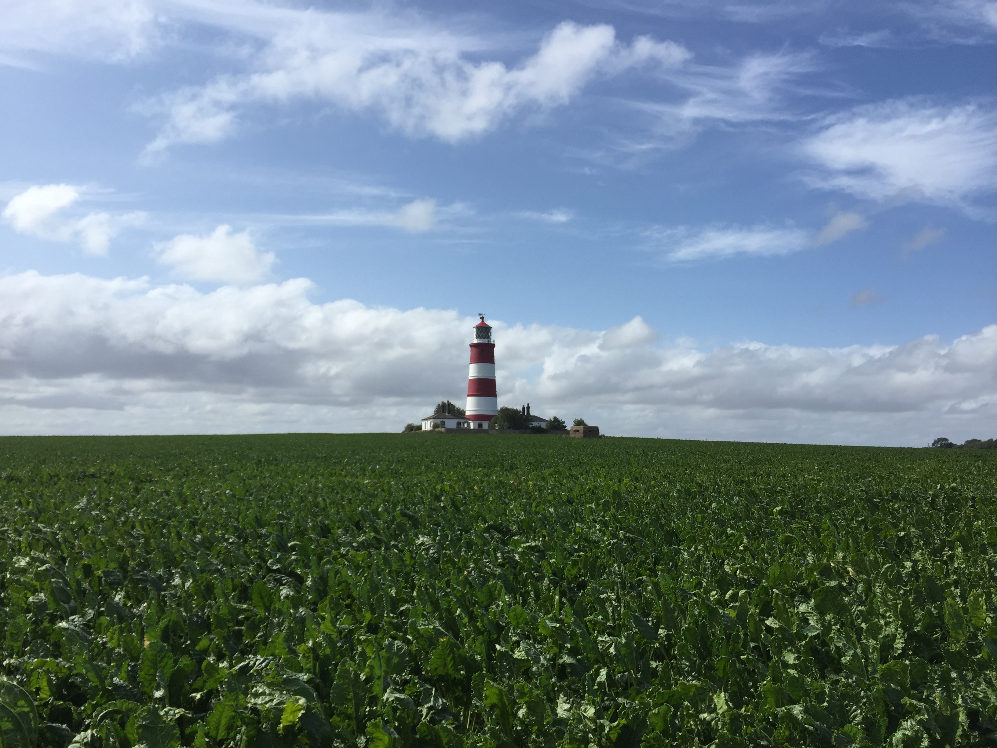
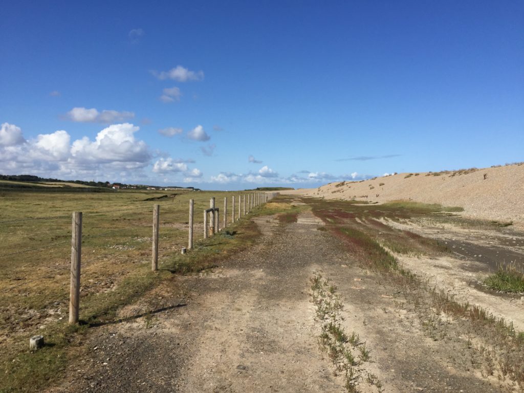
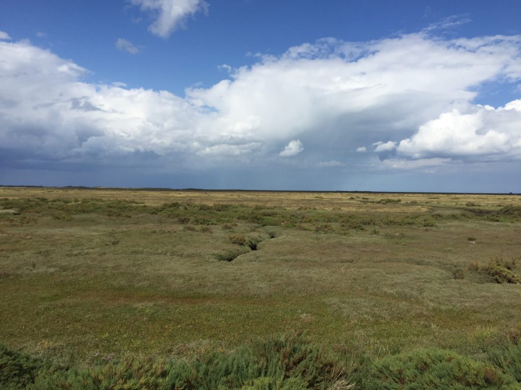
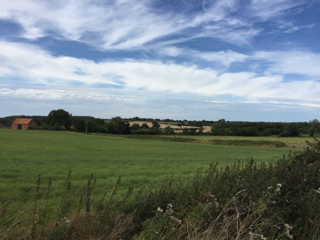
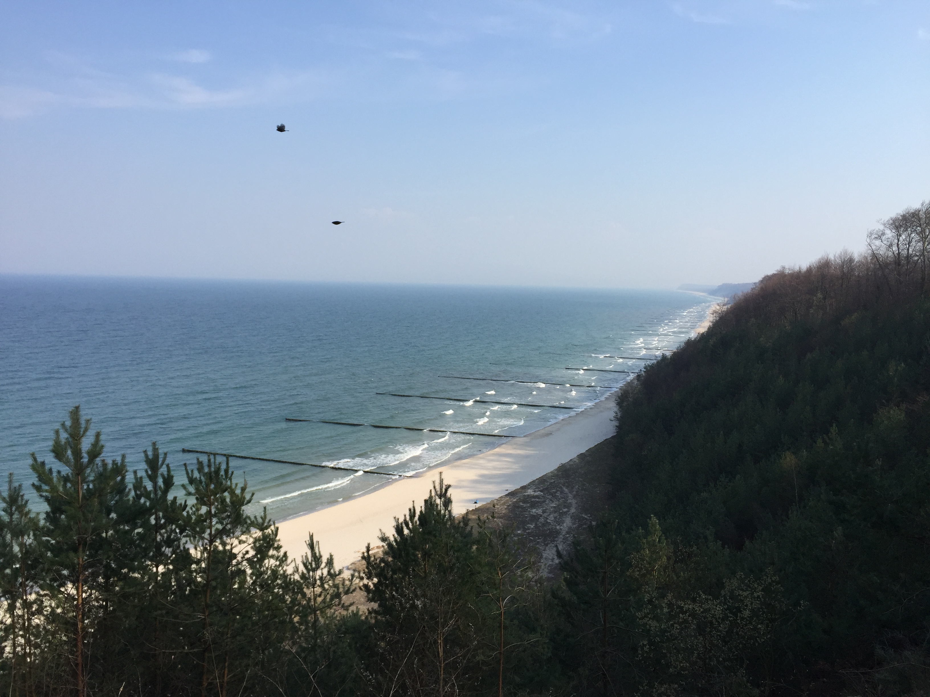
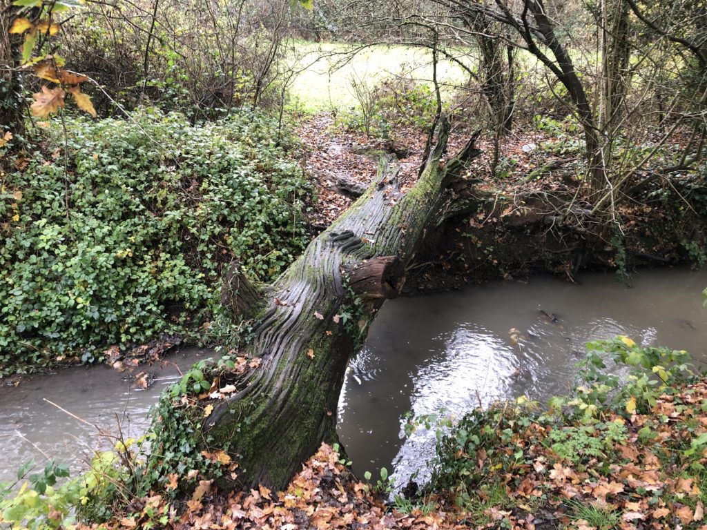
In the autumn of 2019 I went on a number of short walks in the south of the county of Hertfordshire. I found this area appealing since even though it was still the countryside the border to Greater London was close by, and I would frequently encounter the M25 motorway. One of my rambles even followed the very first section of the M25 that opened in 1975, from Potters Bar to South Mimms. Towards the beginning of this walk I had to cross a stream using a slippery fallen tree trunk, which added to the general excitement.

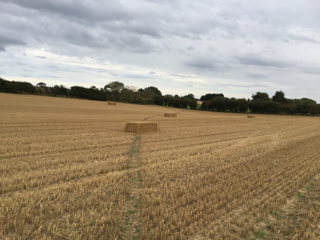
Other Hertfordshire highlights were curious cows, a creepy cornfield, an air rifle shop called ‘Diversity’, and me learning that Stevenage is the UK’s space city.

The most memorable of these walks was longer and started in a more central part of Hertfordshire though. I had developed the desire to visit the city of Watford, which is not easy to explain since it is not generally considered to be a tourist attraction. Maybe the source of this fascination lay in the idiom ”north of Watford”, although it is disputed whether the Watford that gave rise to it is actually the one in Hertfordshire.

I had also never been to St Albans which, on the other hand, is generally regarded as an acceptable sightseeing destination. I thus reckoned that I could go on a walk that includes both cities. And this seemed feasible in practice as well, by starting in Hatfield and stringing together the Alban Way and the Abbey Line Trail. So off I went.

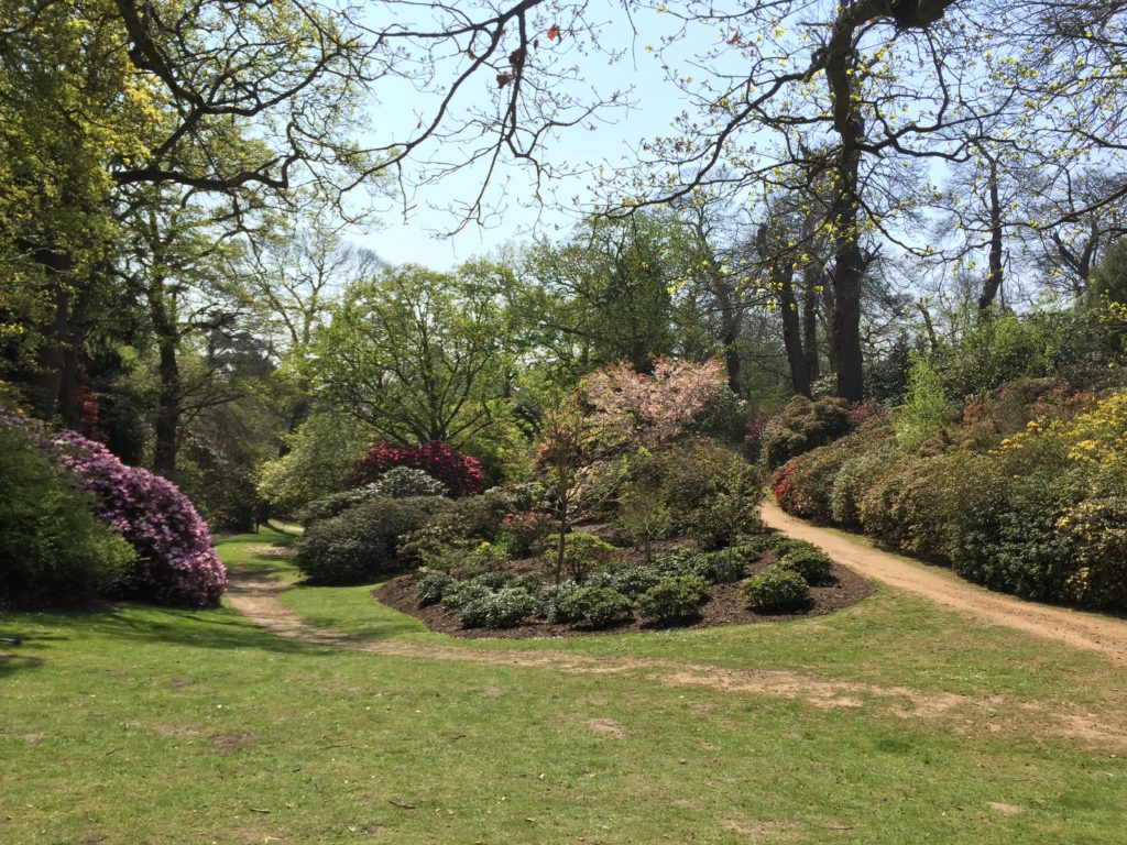
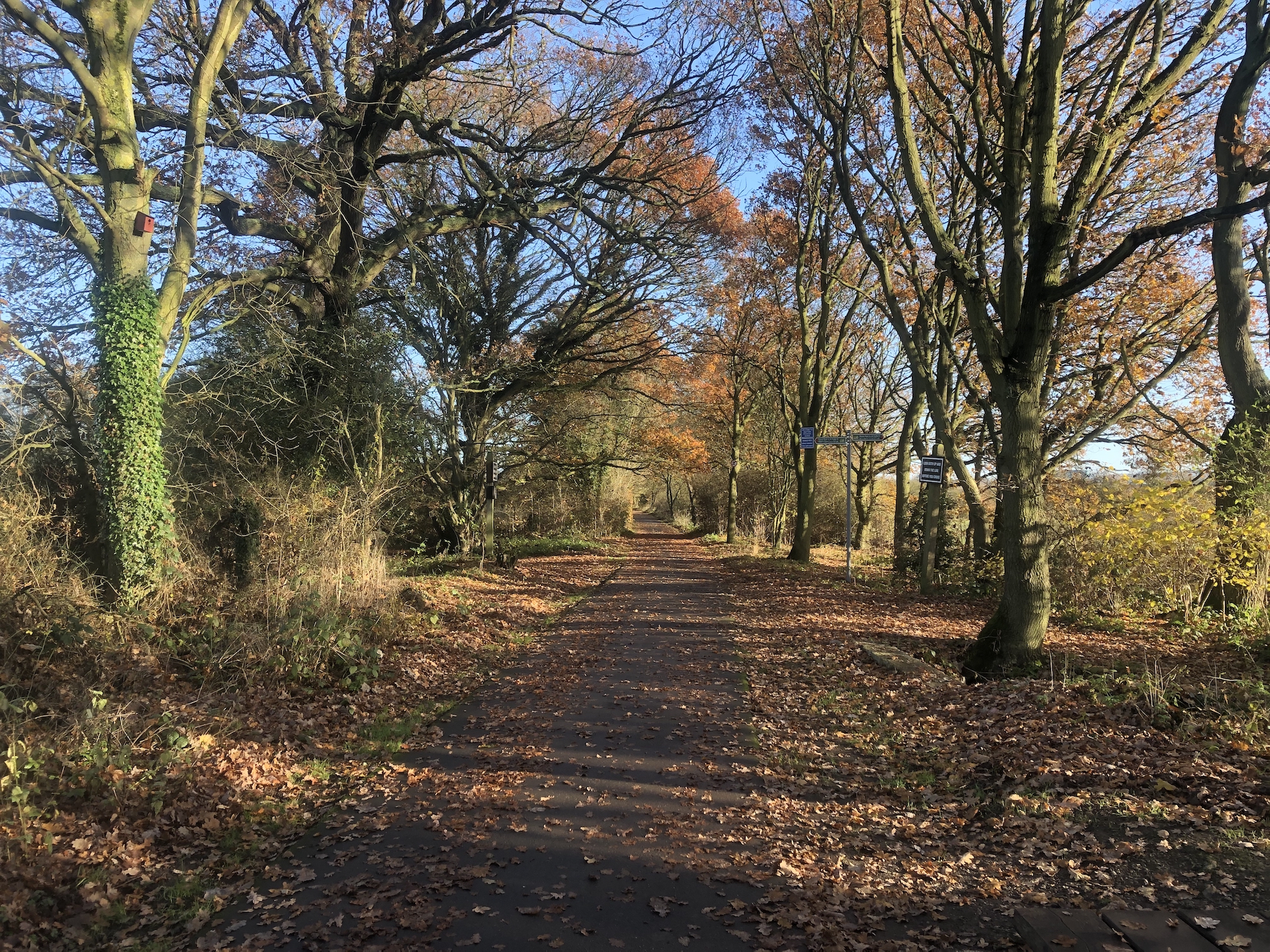
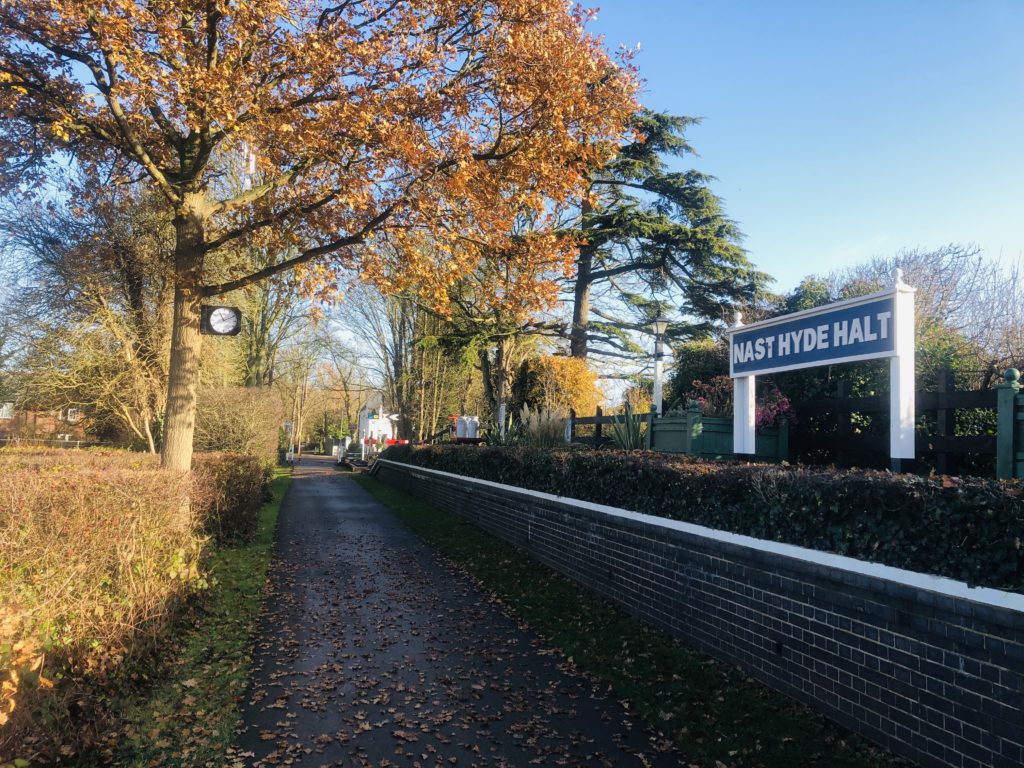
The Alban Way is a hiking and cycling trail that follows a former railway line. The walk began pleasant and uneventful until I noticed a sign indicating a ghost railway station:

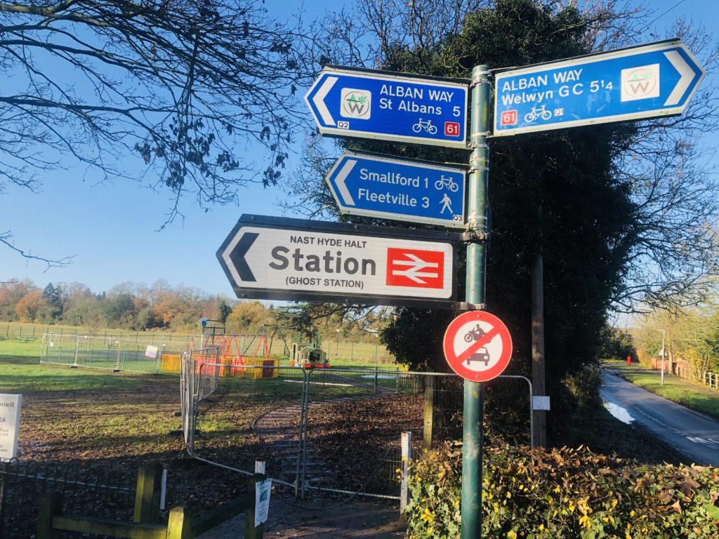
Naturally I was very intrigued by this, and reality didn’t disappoint. Volunteers had rebuilt the former railway station Nast Hyde Halt in a lot of detail, with everything being in place apart from actual trains:

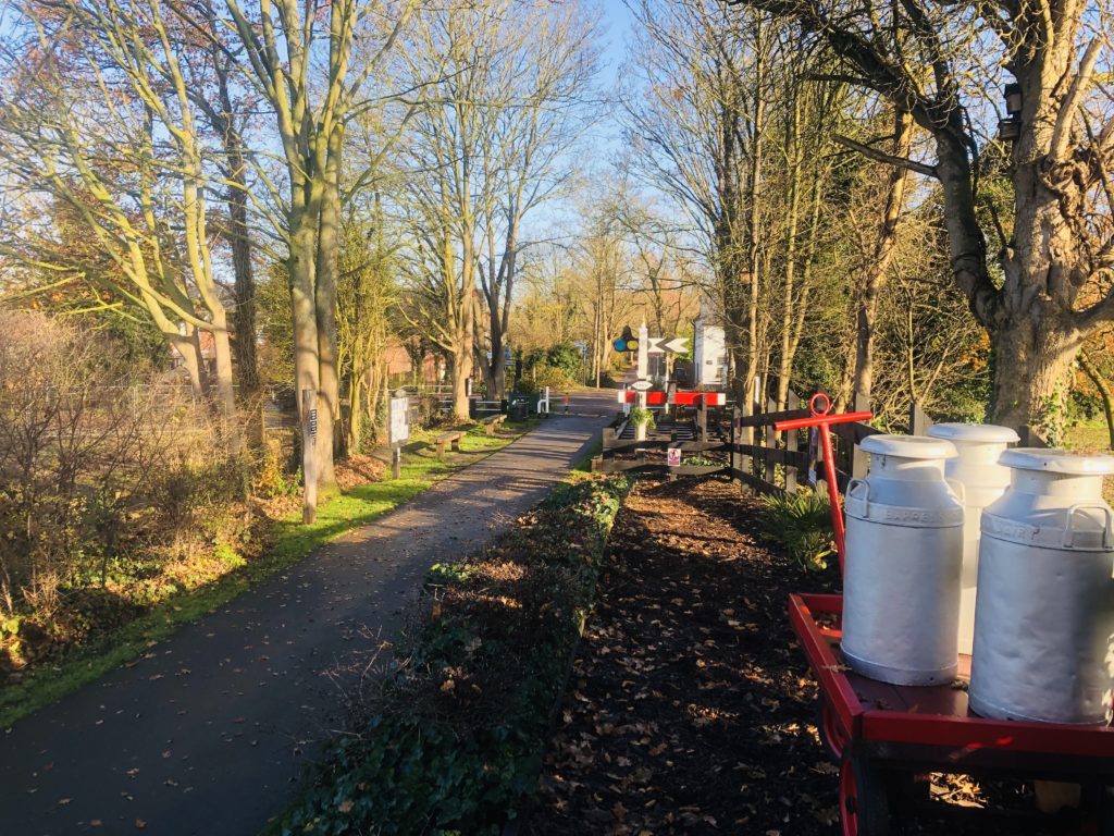
Signs warning about passing ghost trains were found along the way as well. This was a pleasant surprise, which made me glad I had chosen the Alban Way. (Pictures of the original railway station can be seen here.)

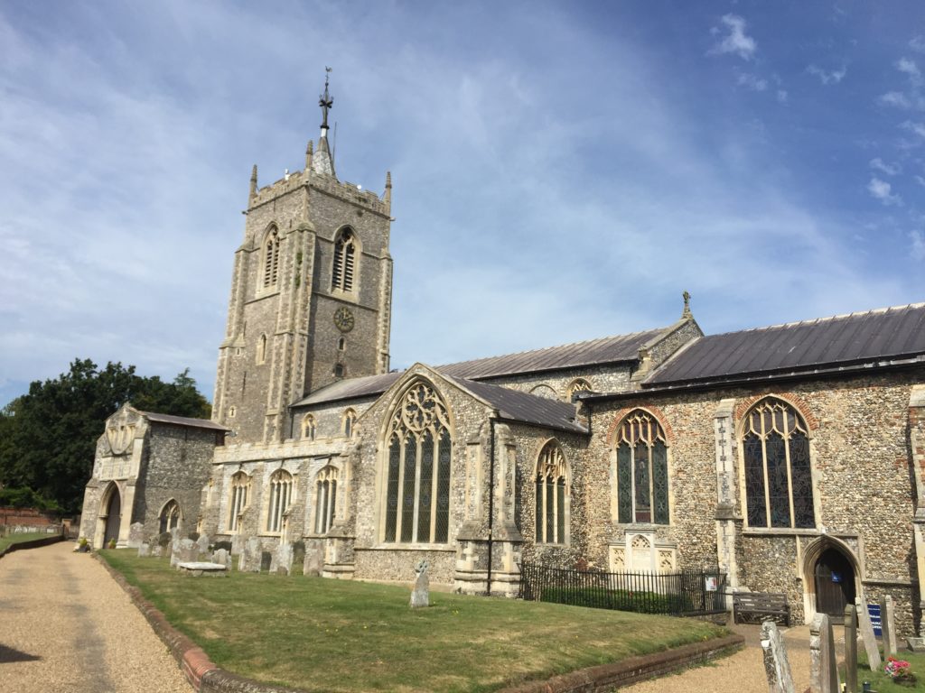
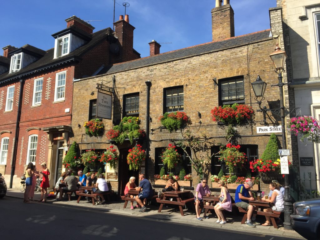
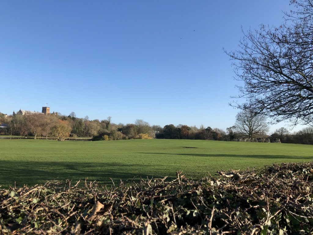
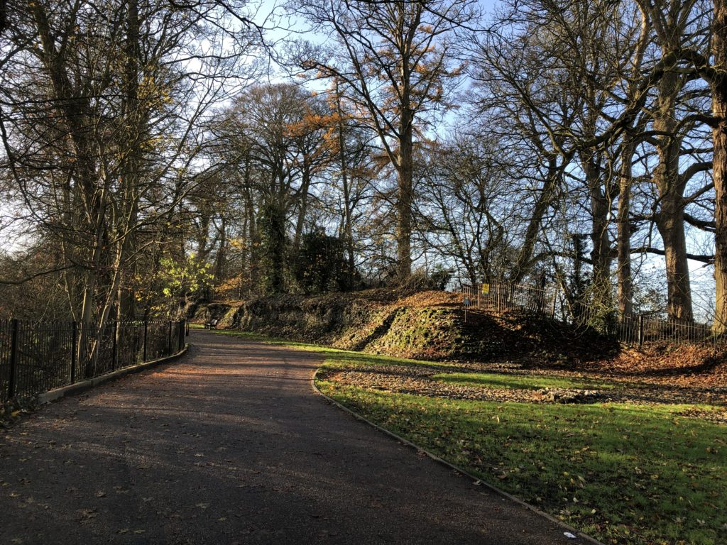
Eventually I arrived in St Albans, and had my lunch break next to the impressive cathedral. It turned out that St Albans had lot to offer: an ‘almost unique’ clock tower, a pub reputed to have accommodated Oliver Cromwell during the civil war, and some remains of the ancient Roman city of Verulamium. The latter brought back some childhood memories, for we used to go on family trips to former Roman towns in Germany, such as Trier or Xanten (the only German city whose name starts with an ‘X’). Not much of Verulamium has remained apart from a couple of stone walls, but walking around the grounds was enjoyable nevertheless.

Thanks to these attractions I had spent way more time in St Albans than anticipated, and so continuing all the way to Watford seemed rather ambitious now. I nevertheless started to head south, as the route was parallel to a working railway line, which would enable me to end the walk early if desired.

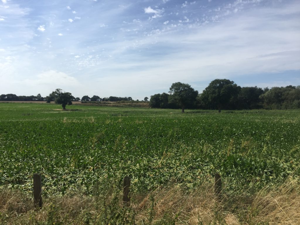
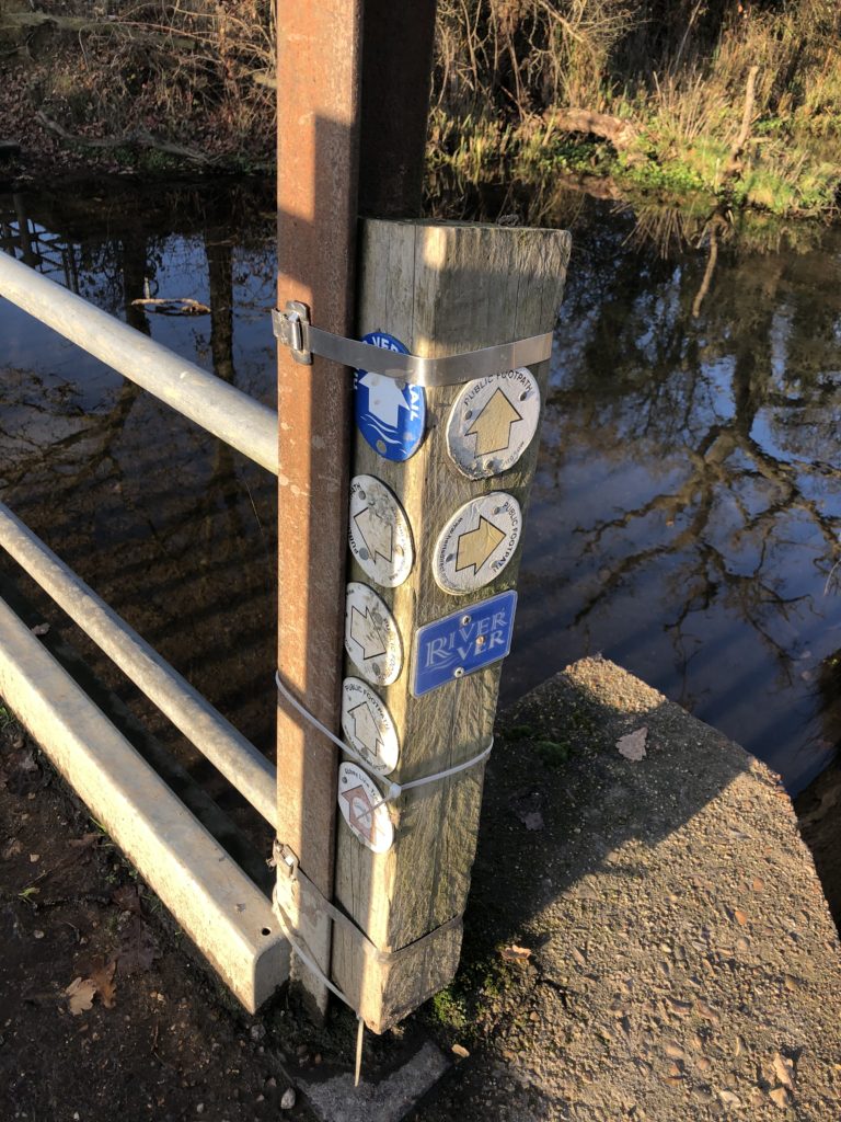
After leaving the suburbs of St Albans behind things got adventurous very quickly. As there had been a lot of rain in the previous days the ground was wet and muddy.  In addition there was a junction with a mind-boggling number of signs pointing in all directions, but the footpaths corresponding to these signs were less easy to make out.

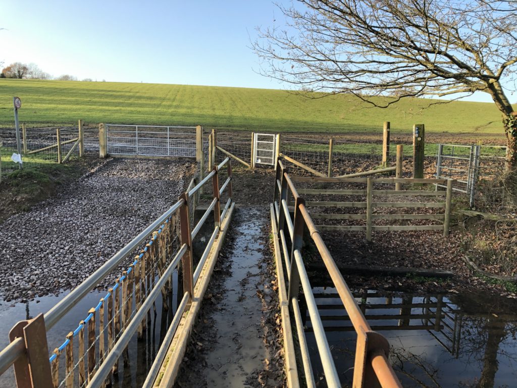
I managed to find the right path, but the mud was a more severe problem, as it only got worse along the way.

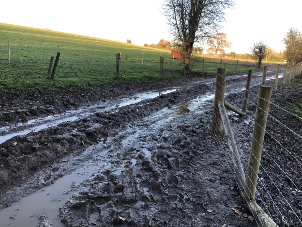
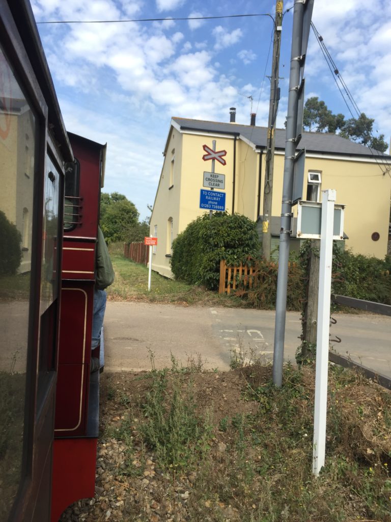
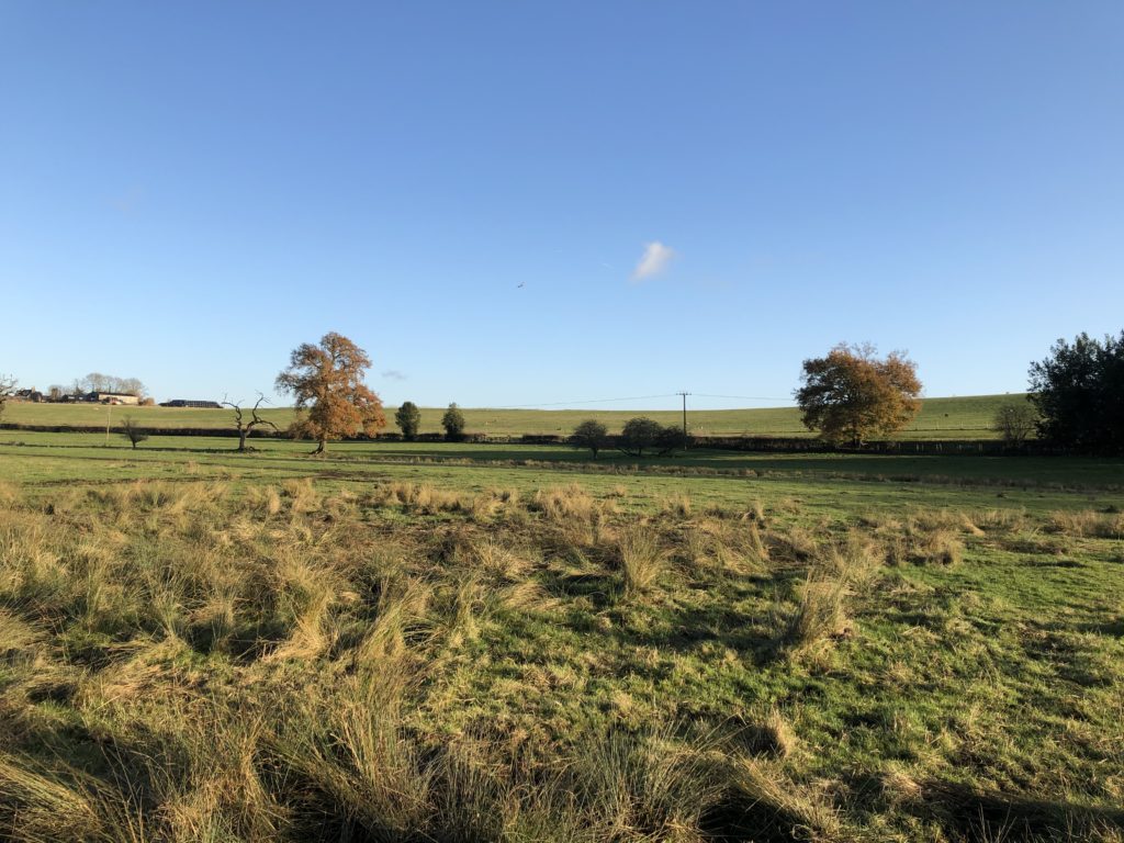
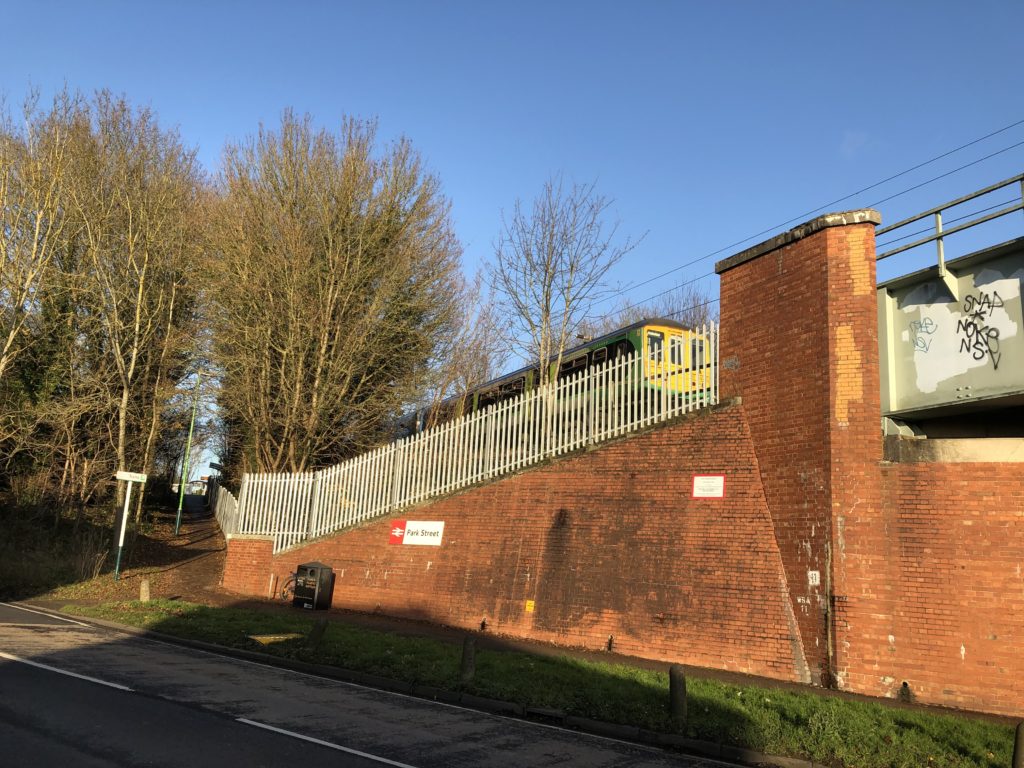
Progress was slow and my feet were wet. I therefore decided to call it a day at the next railway station – Park Street – and take the train to Watford. This was not too disappointing, as Park Street is the least used station in Hertfordshire. Furthermore the last mile was mud-free and very scenic.

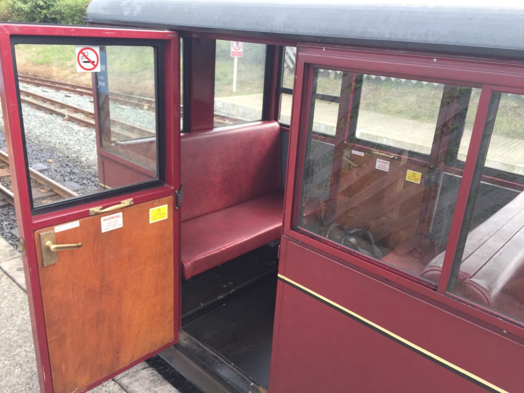
The Abbey Flyer between Watford and St Albans is a cute branch line with only a couple of stops and a very unusual service frequency: the train departs every 45 minutes rather than hourly or half-hourly, which I have not encountered anywhere else so far.

Eventually I thus made it to Watford by rail, where I walked around for a while before making my way home via central London. My impression was that the protagonist of Jonathan Coe’s novel has a point when he says that while Watford is alright, it is not like ”living in Watford, you wake up every morning and think to yourself, Well, life may be a bit shit, but look on the bright side, at least I’m in Watford.” I might come back for further investigations though.

The Wild Side of Norfolk

This entry concludes my three-part series on the Norfolk Coast Path, and I will describe the less popular section between Mundesley and Winterton-on-Sea. It is apt to describe this eastern route as the wild side of Norfolk for two reasons: first, the sea here is much rougher than in the quiet north of the county, and hence many coastal villages are threatened by erosion. Secondly, while in general the Norfolk coast is well served by public transport (especially compared to the Suffolk coast), there is virtually no bus running between Mundesley and Winterton-on-Sea (technically there are a few buses to Happisburgh and Sea Palling on weekdays, but not at times convenient for walkers). These 15 miles thus need to be walked in one go.

I took the train to North Walsham and made the very tight connection for the bus towards Mundesley. I had been there before in order to walk in the other direction to Cromer, which was very scenic:

Since then several instances of coastal erosion have been reported in the news, however, so I am not sure whether the route I took then is still possible. At various points the path had been quite close to the edge of the cliffs.

I also anticipated issues with the Norfolk Coast Path east of Mundesley, since I had read about a diversion due to a novel and extensive sandscaping scheme. It seemed that the work on the beach around Bacton had already been completed, however, since I did not encounter any closed sections on the way.

For the first few miles the path is on or right next to the beach, and I did not pay too much attention to the map. This proved to be a bad move, however, for I missed the spot where the coast path turns inland. Instead I continued to walk along the beach, which got narrower and narrower.

Eventually I could walk no further – the tide was also rising – and it dawned upon me that I must have made a mistake.

I checked the map carefully and indeed, I should be on top of the cliff instead of the beach. I felt unenthusiastic about walking back the last few miles, however, since walking on the sand was not that enjoyable. I thus seriously considered trying to climb the cliffs, but quickly abandoned this project on account of being dangerous and foolish.

There was thus no choice but to double back, and eventually I reached the official path at Ostend Gap.

I really enjoyed this part of the walk: there were roads leading and signs pointing nowhere due to land being lost in coastal erosion. In addition, several abandoned caravans, together with high waves hitting the cliffs down below, created a unique atmosphere.

I then arrived in Happisburgh, which has a very nice lighthouse that can be seen in the header image. The pronunciation of the name of this village is surprising: Haze-bruh. Walking on the cliffs continued to be thrilling:

At some point the coast path rejoined the beach, however, which was worrying. The tide was at its peak now, and from where I was standing I could not make out whether walking on the beach might not lead to a dead-end as before.

In light of the earlier experience I opted for the safe but slightly boring alternative inland route. In hindsight this might not have been necessary, as I saw some dog walkers who seemed to have made it on the beach route.

Eventually I re-joined the beach which had gotten much wider at that point. In the distance I could see some of the nine coastal defence reefs which were built in the 1990s to protect the village of Sea Palling.

After Sea Palling the path leaves the coast and continues behind the dunes, which made this part of the walk less exciting, apart from some oddities on the way.

I walked quite quickly and had soon reached Horsey Gap, which is famous for its seal colony. (There’s also a good windmill nearby). I had already been here on an earlier occasion to look at the seals, and this time I followed the official path instead of going back to the beach. This was because I had planned to have a coffee break at Winterton, but time was tight because of my unplanned extension of the walk earlier that day.

Once again I just about made it before the cafe closed, and sat down for the first time in a long while.

Originally I had wanted to continue from Winterton to Great Yarmouth in order to complete the Norfolk Coast Path, which is another 9 miles. But since I arrived much later than anticipated and was also more exhausted, I decided to cancel the last stretch. This is sad because I have not been able to walk this last bit – which plays a role in Robinson Crusoe – yet, and will not be able to do so in quite a while. Another trip to Winterton is thus on the todo list for 2020.

North Norfolk Double Feature

In this entry I will cover what is probably the most popular section of the Norfolk Coast Path: the route from Sheringham to Hunstanton via Wells-next-the-Sea. I walked it in two parts, the first half immediately following my walk from Ayslham to Sheringham, so let us start there.

I did not sleep particularly well in the youth hostel and my feet slightly hurt from the previous day, so overall I felt a bit groggy. Luckily there was a cooked breakfast and the day was beautiful, so I nevertheless started the walk in good spirits. I was soon richly rewarded, for west of Sheringham the coast path is on the cliffs and provides some spectacular views.

The steam train in this picture is the North Norfolk Railway heading to Holt, which I have used on a previous occasion.

After the cliffs end the paths goes along a beach, from which one can see several anti-aircraft guns up a hill. They are part of the Muckleburgh Collection, a large military museum.

Soon afterwards the terrain started to change, and a massive shingle mountain appeared on one side.

I avoided walking on the shingle as far as I could, but soon there was no alternative.

The shingle was loose, so that each step was hard work and my progress became excruciatingly slow. I assumed that this would only be temporary, but after I had walked on shingle for half an hour I began to suspect that things would continue in this manner for a couple of miles, until the next village. This turned out to be nearly correct, for I luckily managed to find an alternative and much more pleasant footpath for the last mile.

This unpleasant experience made me wonder whether I had missed the route of the official Norfolk Coast Path at some point, but it turned out that the shingle hell is indeed the intended way. Since others have also not enjoyed this part of the walk very much I later found a proposal for a shingle-free detour.

I had now made it to the village of Cley-next-the-Sea, which is pronounced “Clay” and has a nice windmill. I have been wondering about the “-next-the-Sea” suffix, which – unlike the popular “-by-the-Sea” – only seems to be found in Norfolk, but have so far been unable to find any explanation of why this is so.

From this point on the walk became much less eventful, with the landscape for the most part looking like this:

One of the villages on the way is worth mentioning: in the first half of the 20th century Stiffkey famously had a rector who, after an eventful life and career, ended up being in eaten by a lion in Skegness.

Towards the end of the walk I became quite tired, and was pleased when I saw Wells-next-the-Sea appear on the horizon. I arrived there just in time to take the Coastliner bus to King’s Lynn, although the bus driver did not seem very enthusiastic about having passengers. After stating where I wanted to go he responded by saying “You know that you’ll be on this bus for three hours?” (this was repeated to other passengers as well), and pointed out that it would have been faster to take another bus which had left a minute ago. Despite the leisurely pace I enjoyed the scenic journey.

Two weeks later I was back in Wells, in order to tackle the ~22 miles to Hunstanton. Remembering the bus driver’s advice I did not take the Coastliner to get there this time, but the slightly faster route from King’s Lynn which involves changing buses in Fakenham.

Right to the west of Wells is one of the most scenic parts of the Norfolk Coast Path: Holkham Beach, which has appeared in various films and TV shows. It is hence a popular tourist attraction, but once I had moved away from the parking lot I was pretty much on my own:

After Holkham the walk continued to be pleasant but – as the second half of the first stretch – relatively uneventful. Even though it doesn’t quite fit I will use this occasion to insert a picture of a typical Norfolk flint house:

At the village of Brancaster the official Norfolk Coast Path takes an inland diversion away from the coast, which I felt unenthusiastic about. I had done some research in advance which suggested that there is the possibility to walk along the beach instead, however it was not clear whether this route was still passable due to a very recent breach of the beach. I was tempted to just give it a try, but ultimately decided against it because any delay would have meant walking in the dark or terminating the walk early.

After passing this signpost I had nearly reached my destination, and I approached Hunstanton walking on the beach. In an earlier entry I suggested that Hunstanton is not very nice, a statement I now would like to officially retract: the cliffs alone (of which I had been unaware on the earlier occasion) make it well worth a visit.

Another excellent feature of Hunstanton is that it is one of the very few places in the east of England from where there is water to the west, which is ideal for watching the sunset.

Unfortunately I failed to properly use this opportunity since I was hungry after the walk and tried to get some food, but long queues everywhere stopped me both from eating and from seeing the sun set. I regretted this on the bus back to King’s Lynn, but otherwise the walk had been a very enjoyable experience.

Towards the Coast by Steam and Foot

In September this year I went on a couple of walks in Norfolk, with the ultimate ambition to walk the whole of the Norfolk Coast Path. I had done small bits of it before (see here and here), and since the days were long the late summer seemed the ideal time to tackle this project. Ultimately I did not quite succeed, and there remains a 9 mile stretch of the path I have yet to walk, for reasons that will be explained in a later entry.

In order to kick off this undertaking I decided to go on a two-day walk with a stay in a youth hostel in between. This allowed me fit in another item on my to-do list, namely to take the Bure Valley Railway from Wroxham to Aylsham. This is a narrow-gauge steam railway whose one terminus is connected to the national rail network, whereas the other end is sufficiently close to the coast to walk there. This was ideal for my purposes, and so I booked a ticket.

When I arrived in Wroxham there was still a good deal of time left before the steam train would depart, so I strolled through the village.

It is pretty and popular with tourists who want to explore the Norfolk Broads. While looking at the local shops I found that  it is possible to rent small motorboats here without any boating or driving licence, which I found surprising and intriguing. I ended up trying such a boat a couple of weeks later when C. visited, and it was indeed fun even though they are very very slow. My proudest moment on that trip was when I had to reverse into the parking area of a riverside pub with the boat.


For now it was time to take the train though. I had never been on a narrow-gauge railway before, which is half the size of a regular train, and the carriages did look tiny when they drew in.

The train was very popular with families, where in many cases the parents appeared to be much more interested in the proceedings than the children. One father (who looked a bit like David Cameron) started to chat to the engine driver, and was clearly pleased when he could correctly name some of the components of the engine. I could sympathise with this excitement, and soon we started to head north. The ride was quite bumpy but enjoyable, with some nice views of the typical Norfolk countryside.

After arriving in the town of Aylsham I ate a sandwich for lunch in the shadow of the church, in order to be ready for the ~17 miles to the coast. This stretch is the northern end of the Weavers’ Way, whose southern terminus is Great Yarmouth.

After sitting on various trains for several hours I felt full of energy and made swift progress. I soon passed Blickling Hall, one of the two stately homes on this walk. I did not pause here to have a closer look because I wanted to save time in order to reach the other stately home – Felbrigg Hall – before closing time. This was partly in order to have some tea in the late afternoon, but also because the latter was home to Wyndham Ketton-Cremer, who was known to be a great Norfolk enthusiast. I had brought his book “Forty Norfolk Essays” with me, which contains various Norfolk anecdotes from throughout the centuries. One I still remember concerned a local clergymen who became the target of vicious gossip for being too fond of custard, for instance.

The footpaths I walked along were pleasant and free of obstacles, apart from some cows blocking the way. The landscape here even featured some gently rolling hills, and I came across a church with an unusual round tower.

While walking along a country lane I encountered a sign that said “Slow You Down”, which struck me as rather unidiomatic (even though I’m not a native speaker). I later learned that this is an instance of the local Norfolk dialect, and apparently a number of other Norfolk villages have started to put up these signs as well.

Shortly afterwards I passed through the tiny and quaint village of Hanworth (not this one), where a village fĂȘte was in progress. Nearby I saw this milk box, and I couldn’t walk on without checking whether it contained any milk bottles (which it did).

As mentioned before my plan was to have some tea at Felbrigg Hall, where the café closes at 4pm. I had lost some time after taking a wrong turn due to not reading the map carefully enough at one point, so I started to doubt whether I would make it. I increased my walking speed for the last mile and just about succeeded, ordering my tea 10 minutes before closing time.

The Weavers’ Way I had been following leads to Cromer, but my intended destination was Sheringham, where I had booked the youth hostel. After Felbrigg Hall I thus left the Weavers’ Way to follow some unnamed footpaths to the coast. This was more adventurous than anticipated, for one of them led me through a variety of fields with different crops, and with each the actual path became harder to spot:

I ended up in a woodland with so many different paths that I lost track of where I was, so I walked in the direction that intuitively seemed correct. This worked surprisingly well, and I eventually arrived on Beeston Regis Heath, from where I could see the sea for the first time.

By now I had walked more than the 17 miles I had anticipated, and so instead of continuing all the way to Sheringham I went to West Runton railway station to take the train for the last few miles. After checking in at the youth hostel I was very hungry, and went into town to get some fish and chips. There were various shops, but while most were completely empty one was crowded and full of people, so I trusted the instinct of the the masses. I did not regret this decision, and enjoyed my dinner while watching the sunset at the beach.

In the Home Counties

The summer has been quiet, but I have been going on some long walks in Norfolk recently, so soon there will be East Anglia content again. Before that I want to end the series of special posts in which Usedom and Scotland were covered with some notes on a walk in Berkshire I did earlier this year. (The title of this post is thus slightly misleading, as only one Home County makes an appearance).

In a sunny week in spring I for some reason felt like going on a walk which included attractions with more mainstream appeal than those I usually visit, and therefore decided to walk from Ascot to Windsor. It takes a while to get there from Cambridge, but since I always enjoy taking a train from Waterloo station the journey didn’t put me off. I had also considered to start the walk in the suburb of Martins Heron, which is one station further down the line from Ascot, as it was used as the location of the Dursley’s house in the Harry Potter films. Although I decided against this plan in the end, I came across a long and detailed article about where the fictional town of Little Whinging is located within Surrey, which is brilliant as it even manages to come up with a plausible explanation of how the protagonists in the fifth volume manage to reach central London by heading southeast.

The butcher in Ascot seems to be famous, as there was a large queue leading out to the street when I walked past. I headed for the even more famous racecourse, however, and it turns out that it is actually open to walkers on non-race days.

By now I had been walking for about 30 minutes, and realised that the sun was very strong but I had no sun protection. I therefore decided to quickly walk back to the High Street – where the queue at the butcher was still long – in order to buy sunscreen (since then I have also acquired a hat for unusually hot days). Having done this the actual walk could now begin.

I followed some public footpaths which led me to the entrance of the massive Windsor Great Park (2,020 hectares). From here my first destination was Virginia Water Lake, which I thought had inspired a song by Roxy Music, but later it turned out that I misremembered and the name of the song is actually “Virginia Plain”.

Unusually for my walks there were masses of other walkers around this time. I had expected this and feared that it might be annoying, but apparently few people venture more than 15 minutes away from where they parked their car, and so apart from a few clusters most of the park was actually surprisingly empty. The number of dogs probably even superseded the number of people, some of which had quite unusual names such as “Dustbin” or “Nutmeg”.

Near the lake there are some nice gardens and a very peculiar pole. I ate my sandwich for lunch, fascinated by the elaborate picnic arrangement of some groups, which reminded me of one of my favourite The Avengers episodes: on a train John Steed announces that since there is no restaurant car him and Emma Peel have to “rough it”, and proceed to unpack a small table, porcelain cups with saucers, different kinds of loose tea in a wooden box, and so on. (I already mentioned this particular episode before – I have seen others too though!)

After this break I started to head north to get to the beginning of the so-called Long Walk, which runs in a straight line between Windsor Castle and the Copper Horse – a statue of King George III.

The view from here, which can be seen in the header image, is really spectacular. Straight ahead there is Windsor, and to its right lies Heathrow Airport, so one can watch planes landing and departing in rapid succession.

Although I took many pictures of Windsor Castle from the distance, I unfortunately failed to take any good ones when I was closer to it. On the other hand I quite like the following picture of a pub:

The town of Windsor itself is pretty, but hopelessly overcrowded – compared to this the centre of Cambridge on a weekend, which is already pretty bad, can count as quiet. I thus decided to minimise the amount of sightseeing I do in the town, and just had a brief look at Eton on the other side of the Thames.

No surprises here: Not only the crowds of people are similar to Cambridge, but also architecture and terminology (there was a sign indicating where the “Porters’ Lodge” is):

Windsor has two different railway stations: one by Great Western Railway, from which a shuttle train runs to Slough, and second one by South Western Railway, from where trains go all the way back to Waterloo. On a previous occasion I had walked to Slough and caught the train to Paddington from there. This time I headed back to Cambridge in a less idiosyncratic way.

The Ascent of Ben Vrackie

I recently visited my friend X. in Scotland and wanted to use this opportunity to climb up a hill, in order to see how that compares to the flatland walking I usually do. I have lived in Scotland myself for a whole year but did little walking there. The reason for this was that although I had bought hiking shoes before moving specifically to get into walking, these shoes had no ankle support, and unfortunately I discovered after arriving that the local walking club demanded shoes with such support – so I could never join them. In East Anglia this was not necessary though, and so I started going for walks only after moving away from all the hills.

I lacked the local knowledge when planning the trip, but luckily there is a very good database for the Scottish Highlands. X. and I thus decided to climb Ben Vrackie, as this can be done easily using public transport by taking the train to Pitlochry. To get the most out of the day we got up early to catch one of the first trains, but unfortunately this was cancelled – X. luckily checked before leaving the house, and so we could extend our breakfast. Things did not go so smoothly after that either: On the platform at Perth there was large crowd of (partially quite disgruntled) people waiting for the train to Pitlochry (and Inverness), and the dot-matrix indicator displayed the unpromising message “This train is formed of two coaches – Standing room only”.

Naturally this made us concerned about not fitting into the train at all, but miraculously nearly everyone managed to squeeze in. The journey not very comfortable and the train crew were extremely apologetic about the whole situation, but in the end we successfully made it to Pitlochry. The walking could thus begin.

The way to the top of Ben Vrackie can be divided into two stages: The first part leads one from Pitlochry (which is around 150m above sea level) to a lake called Loch a’ Choire at 523m, and – even though I have never experienced anything like it during my travels in East Anglia –  the incline here is relatively gradual. The second part, leading up to the 841m high summit, however, is much steeper and presumably qualifies as hillwalking proper.

The height was not the only thing that made this walk unusual. Scotland’s colour scheme is very different from that of (the south of) England as well, with lots of brown and other dark tones dominating. Furthermore there were many other walkers, roughly two-thirds of which also seemed to be German, whereas on the flatland walks I do one hardly meets anyone apart from a few dog walkers. And finally the wind was pretty strong and cold, so I can now see why many people like hats, scarves, and so on. (I did not get ill though despite lacking all the equipment!)

As we reached the lake and prepared ourselves for the final stage of the ascent the wind became considerably stronger, which made the climb to the top quite the adventure. We did eventually reach the summit though, where the views were spectacular (and there was even some snow).

At this height the wind was so strong that it felt like we might be blown away any second, and I had to hold my glasses because I was afraid that the next gust might send them down the mountain. Since this made staying on the summit rather unpleasant we started to climb down again soon after we had taken an appropriate amount of pictures, although at times we had to stop because the wind made it impossible to move in the direction we wanted to go. Overall the way downhill appeared surprisingly long, and I was thus very impressed with ourselves that we had actually managed to make it uphill.

Back at the lake we rested for a bit, and then decided that we had sufficient energy left to extend the walk some more. Instead of going back the way we came we headed west towards a village with the interesting name Killiecrankie, from where we would walk back to Pitlochry along the river Garry.

This part of the walk was much more relaxed as the decline was gentle, the wind had subsisted, and the valley we headed into looked pleasant and inviting compared to the mountain we were leaving behind.

Down by the river we walked south, with the railway viaduct carrying the Highland Main Line between Perth and Inverness beside us. Despite it’s important-sounding name the line is mostly single track, the service is less than hourly, and the travelling speed is relatively slow – which is why the cancellation earlier that day had caused so much chaos.

Luckily the journey back was more enjoyable, with all the trains being on time and having free seats. Back at X.’s place we ended the day by eating a very well-deserved fish supper.

My verdict in hillwalking is that it seems fun in small doses, but I wouldn’t want to climb a mountain like Ben Vrackie every week, for the day after my knees hurt so much that I could hardly walk at all.

Flatness Abroad: Usedom

This is the first in a series of posts that differ from the usual format in not being about journeys in East Anglia. This time the landscape is still flat, but in the future hills will probably make an appearance as well. There’s no reason to worry though, as I still have a long list of trips I want to make in the East of England.

I recently stayed in Berlin for a week, and wanted to go for a walk in the countryside surrounding the city. Berlin is quite a good base for someone with my tastes: The writer Thedodor Fontane, for instance, was apparently motivated to write his “Rambles in Brandenburg” about the neighbouring federal state because it was perceived to be one of the least interesting parts of the whole country. I preferred to venture somewhat further afield though to Mecklenburg-Vorpommern, which I think can justly be regarded as the East Anglia of Germany: It is flat, rural, remote, and has lots of water.

Initially I had planned a walk between the two seaside towns of WarnmĂŒnde and Graal-MĂŒritz on the Baltic coast, however this could not be implemented since bus replacement services would have made the already very long journey unfeasible. Instead it was decided to go to the island of Usedom, a popular holiday destination. I had already been there once a couple of years ago with C. It had been an extremely hot summer and staying in the city was not enjoyable, so we decided to go to the seaside and stay there overnight on the beach – with only our sleeping bags and no tent, as there had not been any rain in weeks. Unfortunately this changed at around 5am, when we were rudely awoken by a massive downpour, and had to walk through the flooded streets of Zinnowitz to the railway station. There we caught the first (heavily air-conditioned) train for the three-hour journey back to Berlin, and, in our wet clothes, were probably the only people in the city who thoroughly enjoyed the high temperatures.

Despite this memorable precedent C. accompanied me again this time, and soon we were on the branch line to Usedom. We disembarked at the village Kölpinsee, where tiny roads and cul-de-sacs have grandiose names, such as German union street (Straße der Deutsche Einheit) and Diplomat’s way (Diplomatenweg) (only one house).

Thatched roofs are very common on the island, and we came across a good number of them. Not only that, we also walked past the home of a thatcher, which was quite the coincidence since the night before we had watched a documentary about life on Usedom in which that very thatcher was being portrayed, and had talked about how much he enjoys working with the material reed.

We soon reached the end of the village, which was marked by a very German fish restaurant with a humorous weather station:

(Wet stone: rain, white stone: snow, dry stone: sun, shaking stone: wind, invisible stone: fog, stone on the ground: end of the world).

We continued through fields until we reached a place called Loddiner Höft on the southern coast of the island. The views were pleasant, and unlike on the northern site the water here is very still as it is part of a lagoon.

I had bought a map for this walk, however I was not very happy with it as it was not detailed enough, and there were real-life paths that were not shown on it, while other paths that were shown could not be recognised in the real world. According to this map we would have to double-back to where we came from in order to continue our walk, but we saw a well-trodden way through the forest which, so we hoped, would surely also lead us to our destination. Why would it be frequently used if it were a dead end, after all?

We therefore followed the path, which was quite steep at times:

Soon an alternative explanation for the popularity of the path was found though: It ends at a remote beach. On the one hand this was disappointing as we now had to walk back for an even longer time, but on the other hand we had found the perfect spot for lunch.

After that we walked and, for the steep parts, scrambled back to the fish restaurant, from were we headed towards the slightly larger town of Koserow. On this stage of the walk the resemblance to the landscape of East Anglia, in particular some areas in Norfolk, was particularly striking, so I felt very much at home.

On the way we also saw a quaint traditional oven, which I think is used for baking bread: 

In the town we stopped for a coffee break to prepare for for the final part of the walk: The ascent of the Streckelsberg, which with 58 meters is the third-highest hill on Usedom. Overall the hill is dominated by a forest, and one disadvantage of trees is of course that they tend to block the view. Nevertheless there were some spots from which we could enjoy the northern coast of the island, as can be seen in the header image. After descending we walked west along the beach to the village of Zempin, from where we intended to take the train back home.

Our timing was not ideal, for as we arrived at the railway station the next train was in 40 minutes. To pass the time we walked through the quiet village, wondering how many of the houses are holiday homes, and how many have permanent residents. As in so many other German villages the centre of the social life seemed to be the house of the volunteer fire department – which may seem odd, but is pretty standard.

Usedom is so narrow at this point that after about 15 minutes we had again reached the southern end, so we turned around and walked back to the station. Overall this journey can be counted as a success: Flat walks are possible in Germany, and unlike the last time we stayed dry until the end. I therefore plan to explore to Mecklenburg-Vorpommern more in the future.

Mysterious Fenland

I recently read Graham Swift’s Waterland, said to be the Great Fenland Novel. It is an interesting book, but the story is rather bleak: On just over 300 pages the reader encounters murder, incest, child abduction, an unwanted pregnancy which results in a failed abortion attempt, and several unhappy marriages. After finishing the book I was certainly in the mood for some more lighthearted fiction, but nevertheless I also wanted to go on a walk in the Fens.

I had been on a Fenland walk before: The March March march from March to Cambridge, which was a unique experience but mostly involved road-walking; and that I wanted to avoid this time. I therefore decided to walk from Whittlesea to March on the Hereward Way, which is named after an Ely-based 11th century nobleman who led a rebellion against William the Conqueror.

The day was cold but sunny, which is an ideal combination for this area. The first half of the walk consists of footpaths on dykes along various drains, and with no real change in the surrounding landscape this might have been a bit boring, but the sun shining on the ice made the experience pretty enjoyable.

The Fens are a strange place for sure. On the walk I heard the sounds of several dogs barking and howling loudly, but could not see a single dog anywhere – and obviously this was not because a hill obstructed my view. The sounds of the freight trains on their way to and from Felixstowe were also a constant companion, which can be enjoyed at home thanks to some enthusiasts on YouTube.

Unusual things had also happened on the aforementioned walk from March to Cambridge: After taking a picture of a (not very impressive) lake my phone mysteriously crashed and the battery was suddenly completely drained – something that has never happened before or since. Keeping this in mind I brought an external battery this time, which was not needed in the end though.

Eventually I reached the remote village of Turves, whose pub is a real-life instance of the Signs of Disrepair trope:

There was also a road sign which said “Park Here and Use Phone at Crossing”, which I was unsure what to make of. I still don’t know what the purpose of these signs is, since googling the phrase merely led to other people asking about their meaning without any conclusive answers. [Update: See Mark’s comment for an explanation.]

The character of the walk changed after passing Turves, and the at times very muddy footpath leads one through fields and farmland. Probably the most memorable moment of the day was encountering this creepy plastic tree shortly before leaving the village behind:

Eventually I reached the River Nene, where the Hereward Way continues along the bank until March. The footpath here leads directly through some people’s back gardens, from where I spotted two swans sitting between the ice:

Annoyingly a very short stretch along the river – just the area between the two gates – is privately owned, which necessitates a detour via a nearby road. 

As far as I could see this was not signposted, so the map I had bought for the walk was a worthwhile investment.

I approached the town of March from the west and walked past some very nice houses – I think the Fens would really benefit from more pink:

Overall the walk was much less bleak than the novel – but the weather helped, and I would only recommend it for those who truly have a taste for desert landscapes. There are other parts of the Fens I still want to see, but probably not all that soon.

Suffolk Coast (Part 2)

As Lowestoft is Britain’s easternmost place, it is where the sun first hits the island, and luckily the second day of my coastal walk indeed started out sunny.

After a substantial breakfast at the B&B where I had stayed the night I started to head south. In principle the stretch between Lowestoft and Southwold is part of the Suffolk Coast Path, however the official route is for the most part not actually along the coast, but has been diverted inland due to coastal erosion. It is however possible to walk along the beach, provided that the tide is low, and this is what I was planning to do.

Soon after starting the walk the sun was joined by scattered showers, which were fortunately not too annoying, and the combination gave rise to nice rainbows while I left Lowestoft behind.

This walk is clearly more popular than the one from Yarmouth, as I came across many other walkers on the way. By way of a greeting, a man who was walking his dogs pointed out that there had been lot of erosion recently, and indeed I saw even more debris than the day before, including a whole bunker:

After walking on the beach for a while I spotted a path up the cliffs, and went up in the hope that I would be able to walk along there for a change and get a good view. There was indeed a path which led past some fields, but unfortunately it suddenly ended in a steep muddy decline towards the beach: 

As I strongly dislike doubling back I cautiously tried to climb down, but quickly gave up this attempt as the ground was so slippery – it had started to rain more by then – that I would almost certainly have ended up falling into the mud. Grudgingly I therefore walked back to where I had come from and continued the journey along the beach.

Not much later I reached Kessingland, which is roughly the midpoint of the walk and whose beach is very wide and features stones and heathland:

This was one of the most enjoyable parts of the walk, since the unusual landscape made the whole area feel remote and mysterious. I recently watched an episode of The Avengers in which strange events take place on Holkham Beach in Norfolk, and Kessingland Beach would certainly also be suitable to create such an atmosphere.

Eventually I reached the narrow stretch of the beach which is only passable at low tide, and sometimes not even then, as there are a couple of lakes (called broads) inland that are very close to the beach and apparently sometimes breach when there is a lot of rain. For me everything went smoothly however, and I could soon see Southwold in the distance.

I continued the walk along the beach without attempting to go up the cliffs until I had nearly reached Southwold and could go no further, as the way was blocked by concrete structures:

As I did not want to double back again I decided to climb over the concrete blocks to the concrete promenade in the hope that there would be a way up somewhere further down. This was a questionable idea, as the promenade was so slippery that I was genuinely afraid to fall at any moment even though walking with extreme care. I did eventually make it to the stairs up to the cliff without any accident, but would not recommend this experiment – the warning signs on the other hand are certainly appropriate.

I thus had made it to Southwold, which, as expected, and as can be seen in the header image, is very quaint and pretty. (Michael Palin’s entertaining East of Ipswich was shot here.) It is also home to the Adnams brewery whose beers I like (the second brewery featured on this blog), and I visited their brewery store. Among other things they sold Adnams bottle openers and I considered buying one but for some reasons didn’t – a bad decision I have regretted many times since.

After strolling through Southwold, there was the question of what to do next. The original plan had been to stay another night in Lowestoft, and possibly to do some more light walking the next day. In making this plan I had, however, vastly overestimated how long it would take me to finish the walk, as I had imagined the sun to set when arriving in Southwold, but in fact it was only 2:30pm when had done all I wanted to do for the day. After some back and forth I therefore decided to cancel the third day, and go back to Cambridge instead, which was easily possible.

Hopefully this series on the Suffolk coast will continue: The next stretch to Aldeburgh is longer than the way from Lowestoft, but since my walking pace is apparently quite fast this shouldn’t be a problem. Accommodation is the more serious issue, since there are few affordable options in that part of the world. I recently found out that there are a couple of buses that make it in principle possible to get from Cambridge to Southwold, walk to Aldeburgh and then get back to Cambridge again in just one day – provided one starts the journey at an ungodly early hour. A third part might thus be forthcoming in the not too distant future.

Suffolk Coast (Part 1)

I started the new year by going on coastal walk from Great Yarmouth to Southwold with a stay in Lowestoft. This was partly inspired by W. G. Sebald’s famous The Rings of Saturn, in which the narrator follows the Suffolk Coast Path. In a film based on the book, Robert MacFarlane says that one should not walk this route merely because one likes Sebald, but luckily this did not apply to me since I am of course interested in walking through East Anglia anyway.

Sebald starts in Somerleyton, home of the inventor of the hovercraft. I didn’t want to wait to see the seaside though, and so decided to begin my walk in Great Yarmouth and hence in Norfolk. In order to get the most out of the daylight I took an early train from Cambridge, but unfortunately missed the connecting train in Norwich by one minute and had to wait there for a whole hour. This proved to be a benefit rather than a nuisance however, since the next train to Yarmouth ended up being loco-hauled by class 37s:

These and their memorable sound already made an appearance in the post about the walk to Great Yarmouth; but I had never actually used this kind of train before and was hence very pleased.

After arriving in Yarmouth I walked along a road south towards Gorleston-on-Sea. The weather was quite pleasant, and I soon reached the end of Yarmouth and the beginning of Gorleston:

I walked along the promenade, at the end of which I joined the Norfolk Coastal Path.

Pretty soon the path disappeared, however, because the cliffs and dunes along the beach have been eaten up by erosion. I thus had to continue walking along the beach, on which one can find debris of fences that used to stand at the edge of the cliffs:

At some point it was possible to leave the beach and continue on top of the cliffs, from where the view was much better. There was no shortage of uninviting notices, however: The concrete promenade along the beach is no longer accessible, and soon the cliff path itself ended with an assortment of warning signs:

While in Norfolk the coastal path is signposted well, but after I had crossed the border to Suffolk no more sign were to be seen. According to my map the footpath did nevertheless continue all the way to Lowestoft, but I had some trouble locating it in the real world, and ended up in a muddy field next to a rifle range.

Eventually I arrived at the edge of a Caravan park. There was a path along the cliffs which I assumed would be the public footpath, however strangely enough it was fenced off from all sides and could not be used. Since there was no other way out I had to walk through the caravan park instead, staying as far away from the caravans as possible. After that I went through some more fields until I reached the village of Corton, where for the first time since entering Suffolk there was a public footpath sign. Unfortunately, however, what this sign said was that the footpath along the coast had been lost due to coastal erosion.

Subsequent investigations showed that the clifftop path I had seen on my map was destroyed in the winter of 2012. (Unlike other counties, Suffolk doesn’t seem to have a list of closed and diverted footpaths online, so it was difficult to predict these complications). One can thus not recommend walking the route I had taken, because the way through the caravan park is on private land. This is very unfortunate, since as far as I had been able to make out is is also not possible to walk this stretch on the beach either.

After passing through Corton Lowestoft was now close. I had never been there before and was very curious, since it is Britain’s most easterly town and home to the easternmost point of the country. As usual for the seaside, the border between town and country was marked by caravans:

This is what Ness Point – Britain’s easternmost point –  looks like:

It must be admitted that it is probably not the most spectacular extreme point, a view which is also reflected in a number of harsh reviews of the location on Google Maps. The reason for this is presumably that Ness Point is located in quite an industrial part of Lowestoft, as is indicated by the rather prosaic street names nearby:

I was pleased to find that Lowestoft has more scenic parts as well, especially the promenade south of the river. Here there are rows and rows of traditional British hotels and bed and breakfasts, in one of which I stayed the night – as the only guest, in fact, since January is not exactly high season.

My stay there was very pleasant, and the next day I was ready to continue my coastal walk to Southwold, which will be the topic of the second part.